The Philippines are home to an astonishing collection of over 7,600 islands, only 2,000 of which are permanently inhabited. While many of these islands are not considered much more than an idyllic atoll perfect for a lazy day trip, some battle it out for the world record as some of the largest on Earth.
Counting our way down from the smallest to the largest when measured by total land area, here are the largest islands in the Philippines.
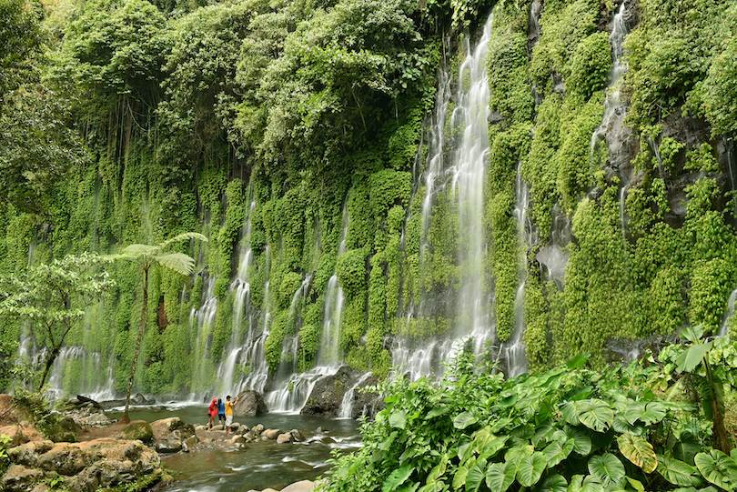
10. Bohol (3,821 km2)[SEE MAP]

Located within the province of the same name, the oval-shaped Bohol Island is a picturesque isle characterized by picturesque coral reefs, quaint stone churches, indigenous (and mischievous) tarsier monkeys, and thousands of brown-hued limestone formations known collectively as the Chocolate Hills.
There are over 162 miles of coastline to be found on the main island itself, dotted with everything from waterfalls to natural caves. As if that wasn’t enough beauty within one place, there are also a further 70-plus satellite islands located within easy reach.
9. Cebu (4,468 km2)[SEE MAP]

Lovingly dubbed the ‘Queen of the South,’ Cebu Island is the largest island in the Visayas region, and right up there as the 126th largest island on Earth. Stretching for over 120 miles from top to bottom, this sun-soaked island is a plethora of dramatic coastlines, beautiful beaches, limestone hills, and glorious coral atolls just offshore.
Home to over 3.5 million people, the island of Cebu is a tropical paradise. It consists of big pockets of developed areas, particularly around Cebu City, with its interesting mix of Spanish colonial history, leaving the rest of the island largely untouched. Once the 17th-century country capital, Cebu island – along with hundreds of other smaller islands – makes up the bustling province of Cebu.
8. Leyte (7,368 km2)[SEE MAP]

Leyte island in the Visayan archipelago can be found in the Camotes Sea, linked to the island of Samar by a massive bridge. Once home to 16th-century Spanish explorers known as the Tandaya, the island is most famous for the four-day-long Battle of the Leyte Gulf that was warred here against the Japanese. With more than 200,000 fighters, it is considered to be the biggest naval battle of World War II.
Today, the island is a peaceful farming country with rice, corn, coconuts, and tobacco being some of the most important trades, particularly in the lush and fertile Leyte Valley.
7. Mindoro (10,572 km2)[SEE MAP]

Mindoro is a large island located southwest of Luzon and northeast of Palawan. It is home to over a million people and split into two provinces – Occidental Mindoro and Oriental Mindoro.
Stretching for over 100 miles along its length, the island is celebrated for its deep valleys, and tamarau water buffalo found nowhere else on Earth. Mindoro is the perfect escape for fly and flop holidays – outside of the monsoon season, of course – with spectacular white-sand beaches and meandering rivers and lakes.
6. Panay (12,011 km2)[SEE MAP]

The triangular-shaped island of Panay is the most westerly of the Visayan Islands in the central Philippines. It is the fourth most populated island in the huge archipelago, home to nearly 4.5 million people at last count. To put it into perspective, that’s 4.4% of the entire country’s population.
While beautiful in itself, with countless mysterious caves and rivers, Panay island is often used merely as a stepping stone for reaching more-popular Boracay and its celebrated White Beach.
5. Palawan (12,189 km2)[SEE MAP]

Palawan is the largest island in the Palawan province. With the South China Sea on one side and the Sulu Sea on another, the island remains largely – and blissfully – undeveloped by tourism, by most standards.
Instead, visitors descend to appreciate the astonishing jungle scenery, magnificent white-sand beaches, and epic wildlife. In fact, it is even referred to as the ‘last ecological frontier’ in the Philippines because of its commitment to nature conservation. In 2016, the island of Palawan was voted the ‘most beautiful island in the world’ by both Conde Nast Traveller and Travel + Leisure.
4. Negros (13,310 km2)[SEE MAP]

The boot-shaped island of Negros is one of the Visayas island cluster. Fringed by the Visayan Sea in the north and the Sulu Sea in the south, it boasts over 100 miles of coastline worth exploring.
The island is famous for its agricultural and mining resources that have made it one of the wealthiest regions in the Philippines. Most of the land is made up of sugarcane plantations, sugar mills, copper or coal mines, and cornfields, but rice, coconuts, and other fruit are also grown here. Offshore, the island’s underwater reefs and coral gardens make it unsurprisingly one of the Philippines’ top diving destinations.
3. Samar (13,429 km2)[SEE MAP]

Samar island is the most easterly located island of the Visayas group in the central Philippines, surrounded by the Samar Sea, the Philippine Sea, and the San Bernardino Strait.
Made up of no less than three provinces and connected to Leyte by the San Juanico Strait, about a third of its land is protected by Samar Island Natural Park – the largest connected section of old-growth forest in the Philippines. While it doesn’t have the iconic mountains that the rest of the island archipelago is known for, it is still a largely hilly island punctuated with scenic coastal plains and flood lands.
2. Mindanao (97,530 km2)[SEE MAP]

The unusually-shaped Mindanao island is a massive mountainous island in the southern Philippines. Stretching for nearly 300 miles from north to south and encompassed by the Bohol, Celebes, Philippine, and Sulu seas, the island of Mindanao is a volcanic wonder.
It is home to Mount Apo – the tallest peak in the country – and the highest concentration of different ethnic minorities in the Philippines, including the Maranao, Maguindanao, and the Sangil people, to name just a few.
Dubbed the ‘pioneer frontier’ because of its huge stretches of untouched fertile land, the island makes a living through agriculture. The main crops are corn, rice, and various fruit, but coffee and cacao are also grown here.
1. Luzon (109,965 km2)[SEE MAP]

The island of Luzon has many claims to fame. Not only is it the Philippines’ largest and most populated island, but it is famously the 15th largest island on the planet when measured by land area.
Located in the northern Philippines, Luzon is both the nation’s economic and political hub. It is home to more than 50 million people at last count, which is more than half of the Philippines’ total population – granting the island its final title as the fourth most populated island in the world.