Perched on a small tidal island in the western Highlands, this is the kind of landmark that makes drivers hit the brakes and passengers reach for their cameras. Eilean Donan Castle appears around a bend on the A87 near the village of Dornie, and it’s hard not to be impressed. Stone walls, a sturdy keep, water everywhere you look—it’s got that classic Highland drama.
What really makes Eilean Donan Scotland’s most photographed fortress? It’s not just the building (though that’s impressive enough). The real magic is the way its rugged silhouette stands where three sea lochs meet, with steep, heather-covered mountains rising behind. The scenery just does its own thing. Point your phone at it from almost anywhere—chances are, you’ll end up with a photo worth keeping.
Island Setting And Highland Backdrop
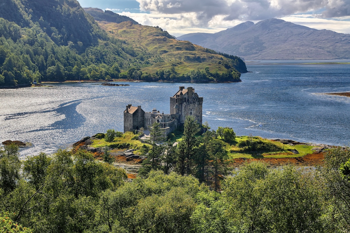
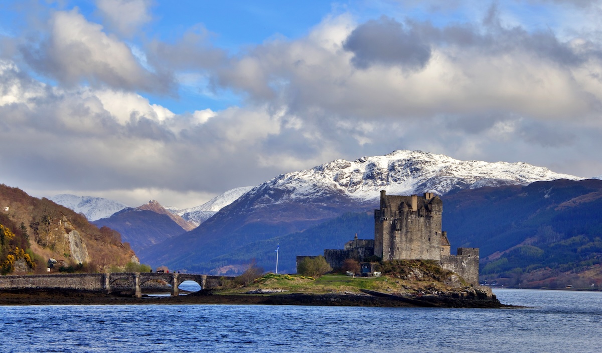
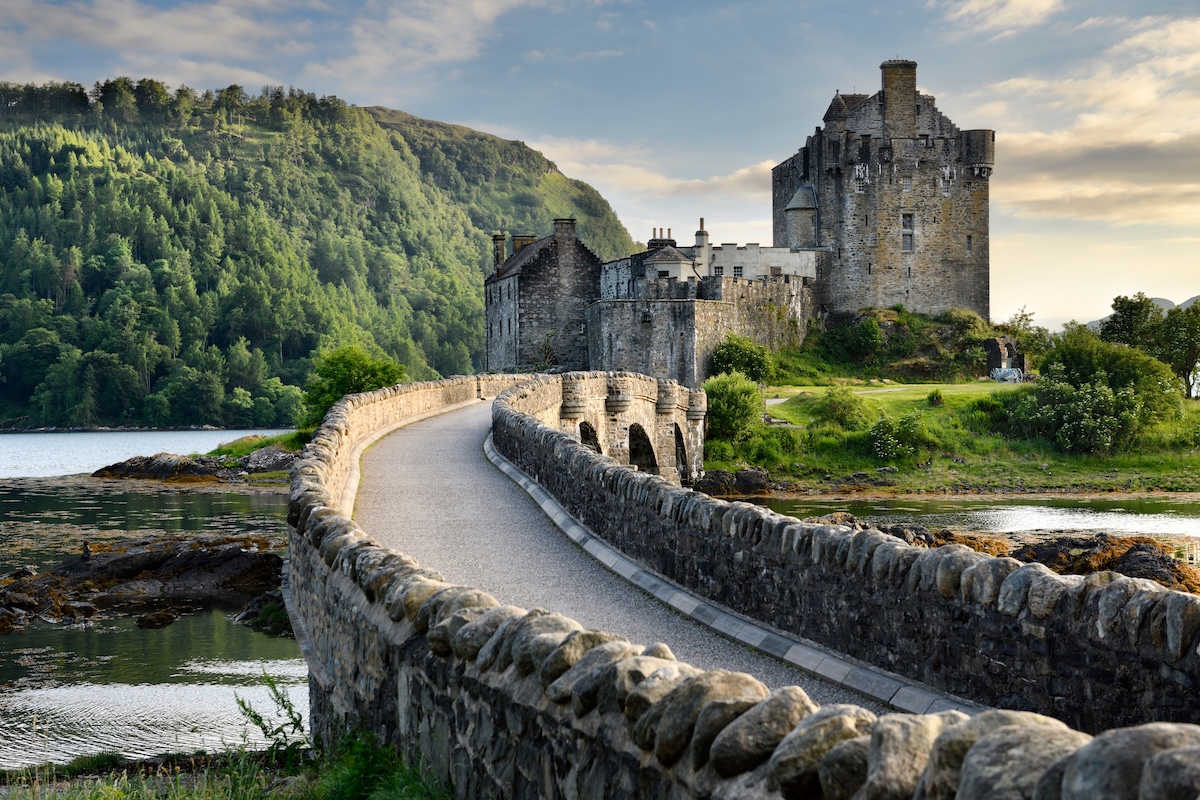
To get to Eilean Donan, you walk a short arched footbridge from the mainland, with Loch Duich, Loch Long, and Loch Alsh all spreading out around you. The island’s tiny—pretty much just the castle itself—and the water comes up close on every side. When the tide’s high, the lochs almost swallow the shoreline, leaving the castle looking isolated and dramatic without anyone needing to try too hard.
Behind the castle, the hills of Kintail rise sharply to the south and east. On clear days, you can trace the ridgelines for miles, but when it’s overcast, low clouds wrap the peaks and leave the castle standing against a moody grey backdrop. Honestly, a lot of photographers seem to prefer that look.
The best views? You get them before even crossing the bridge. There’s a wide layby along the A87 near Dornie—pull over and you’ll see the classic shot: bridge in the foreground, castle in the middle, mountains behind. Late afternoon light? That’s when the stone glows and the reflections across the loch get really good.
If you’re driving the North Coast 500 or heading to Skye, the castle is right on your route. It’s about an hour from the Skye Bridge at Kyle of Lochalsh, and maybe ninety minutes from Inverness. You’ll pass quiet single-track roads, scattered crofting villages, and long views down the lochs—honestly, it’s worth slowing down for.
A Brief Historical Background
The island probably gets its name from Bishop Donan, a sixth-century Irish missionary who might’ve started a small religious community here around 580 AD. You’ll still find some local churches named after him.
In the thirteenth century, someone built a stone castle on the island to defend against Viking raids along the western coast. Thanks to its spot where three sea lochs meet, it became a natural chokepoint. Whoever held the castle controlled a big stretch of the Highlands.
For centuries, Eilean Donan belonged to the Clan Mackenzie and their allies, the Macraes. The castle went through sieges and plenty of political scheming. But in 1719, things took a turn. During a Jacobite uprising, Spanish troops joined in, and three Royal Navy frigates hammered the castle. When a gunpowder store inside blew up, Eilean Donan was left in ruins.
For about two hundred years, the place was just broken walls and rubble on a windswept island. Then, in 1911, Lieutenant Colonel John Macrae-Gilstrap bought the island and kicked off a long, painstaking restoration. He relied on old ground plans and, honestly, a lot of grit. After twenty years, the rebuild wrapped up in 1932.
So, what you see now is mostly that early-twentieth-century restoration, not some untouched medieval relic. Still, knowing that doesn’t take away from the experience. The restoration feels thoughtful, the stonework is sturdy and convincing, and the landscape—well, that’s as wild and dramatic as it’s always been.