
The United States stretches across an incredible range of elevations, from low, flat coastlines to mountains that dominate the horizon. Each state lays claim to its own highest spot, and together they show off just how varied America’s geography really is.
These high points run the gamut—from gentle hills just a few hundred feet high to some of the continent’s most formidable peaks. Some are right off the road, while others demand real stamina and sometimes technical climbing to reach.
Maybe you’re a dedicated peak bagger, or maybe you’re just curious about what’s above you on the map. Either way, these summits say a lot about the land beneath our feet. From volcanic giants out west to the old, weathered ridges of the East, every state’s highest elevation brings its own quirks and challenges.
Alabama: Cheaha Mountain (2,413 feet)
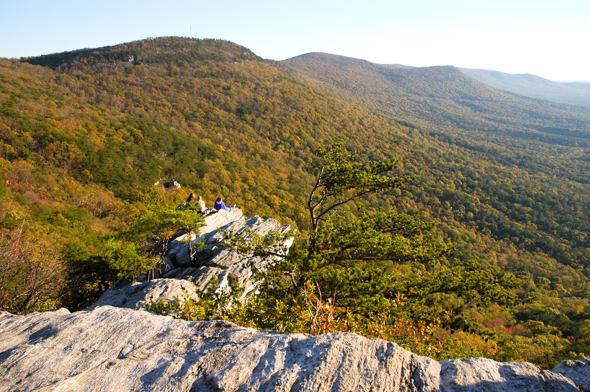
Alabama’s highest point, Cheaha Mountain, rises to 2,413 feet in the Talladega National Forest. It’s right inside Cheaha State Park, which opened as Alabama’s first state park back in the 1930s. From the top, you get broad views of the Appalachian foothills rolling across east-central Alabama.
Trails here range from easy strolls to more demanding hikes, including the Pinhoti Trail, which links up with longer routes through the region. You’ll pass rock outcrops, thick woods, and sometimes even waterfalls. There’s an observation tower on the summit that’s worth climbing if the weather’s clear. If you’re making a trip of it, the park has campgrounds, a lodge, and plenty of picnic spots—so you can easily turn your visit into a weekend.
Alaska: Denali (20,310 feet)
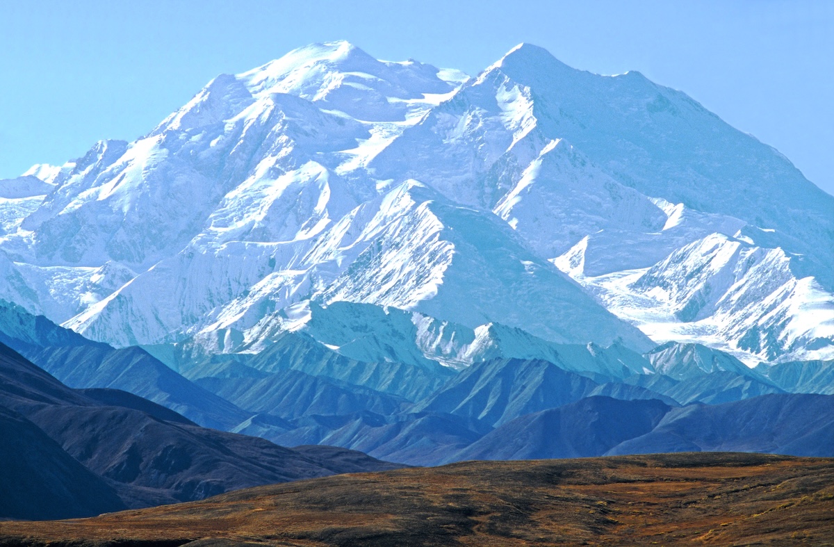
Denali really stands alone among U.S. high points. This massive mountain dominates Alaska’s interior at 20,310 feet, making it not just the state’s highest spot but the tallest in all of North America. The name comes from the Athabascan word for “the high one.”
You don’t have to be a mountaineer to experience Denali. Denali National Park offers plenty of places to gaze at its snowy slopes—though, honestly, clear views aren’t guaranteed. The mountain makes its own weather, and only about a third of visitors even see the summit thanks to thick clouds. For those who do want to climb it, Denali is a serious undertaking: you’ll need technical skills, physical grit, and a few weeks to spare.
Arizona: Humphreys Peak (12,633 feet)
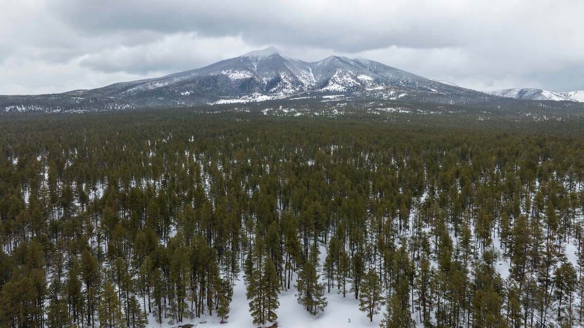
Arizona’s highest point, Humphreys Peak, tops out at 12,633 feet in the San Francisco Peaks north of Flagstaff. It’s a dormant volcano in the Coconino National Forest, rising well above the desert landscapes most folks picture when they think of Arizona. Several Native American tribes, including the Navajo and Hopi, consider the summit sacred.
The trail to the top covers about 4.5 miles, with over 3,300 feet of elevation gain. You’ll walk through alpine meadows and old bristlecone pines before hitting the rocky, windswept summit. Best time to go is usually July through September—that’s when the snow is gone, though you’ll want to watch for afternoon storms. On a clear day, you can spot the Grand Canyon from the top, along with sweeping views across northern Arizona.
Arkansas: Mount Magazine (2,753 feet)
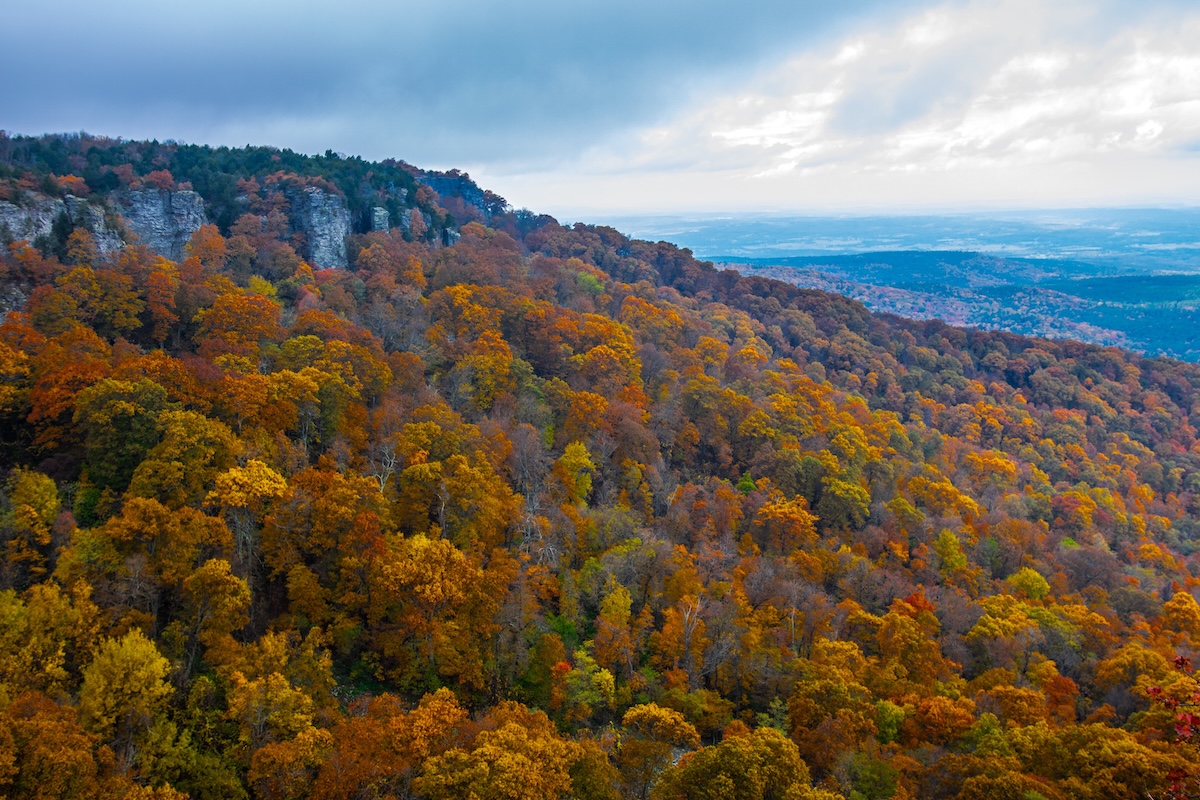
Arkansas’s highest point, Mount Magazine, stands above the Arkansas River Valley in the Ozarks at 2,753 feet. It’s a world away from the state’s flat delta lands. You’ll find it in Mount Magazine State Park, and you can actually drive right up to the summit.
The park’s got well-marked trails, campsites, and a lodge if you want to stay overnight. From the top, you can see for miles across the Petit Jean River Valley and Ouachita National Forest. Rock climbers love the sandstone cliffs here, and in cooler months, you might cross paths with deer or even black bears. Spring brings wildflowers all over the plateau.
California: Mount Whitney (14,505 feet)
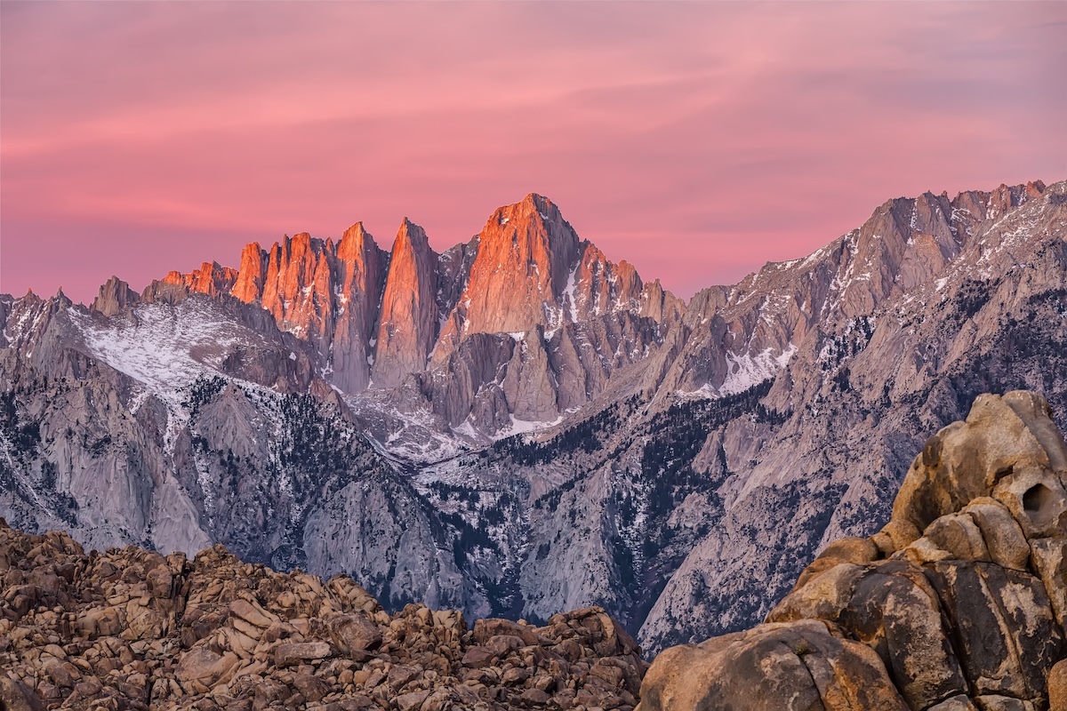
California’s Mount Whitney rises sharply along the eastern Sierra Nevada, hitting 14,505 feet—the highest point in the lower 48 states. It straddles Sequoia National Park and Inyo National Forest, looming over the Owens Valley.
If you want to summit Whitney, you’ll need to plan ahead. Permits are in high demand, especially since the main trail is a bucket-list hike for so many. The route is about 11 miles one way from Whitney Portal, with a whopping 6,000 feet of elevation gain. Some push it in a single day, but most hikers spread it out overnight. July to early October is usually best—less snow, though mountain weather can always surprise you, and the altitude is no joke.
Colorado: Mount Elbert (14,440 feet)
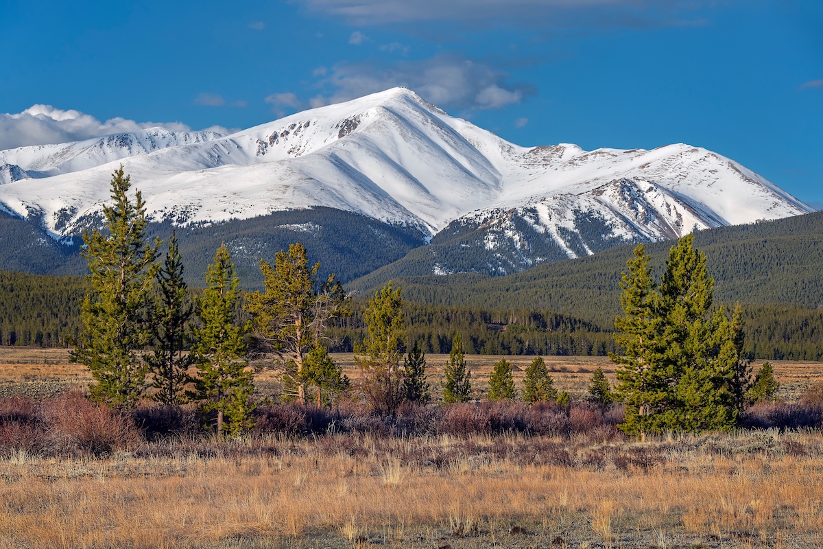
Standing on Mount Elbert puts you at the highest spot in Colorado and the entire Rocky Mountains—14,440 feet up. It’s part of the Sawatch Range near Leadville, inside San Isabel National Forest, and it’s a magnet for hikers in summer.
The climb is tough but doesn’t require ropes or technical gear if you stick to the main season. You can pick from two main routes: Northeast Ridge or South Ridge, both with about 4,500 feet of gain. Most people finish in seven to nine hours, but starting early is smart—afternoon storms are common. At the summit, you get wild, wide-open views of the Rockies that are hard to beat.
Connecticut: Mount Frissell, south slope (2,379 feet)
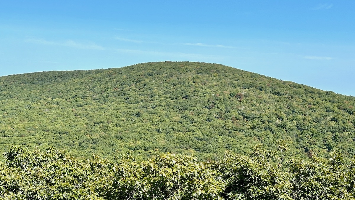
Connecticut’s highest point isn’t actually a peak, and it’s not even the top of Mount Frissell—that’s in Massachusetts. Instead, the state’s high point is a spot on the south slope at 2,379 feet, right on the border in Salisbury.
To get there, you’ll hike through the Taconic Range on trails that wind through thick forest. The spot is marked, though you won’t find a dramatic summit or sweeping vistas. Still, the walk itself is lovely, and this quiet corner of Connecticut is classic New England upland—peaceful, green, and a little off the beaten path.
Delaware: Ebright Azimuth (448 feet)
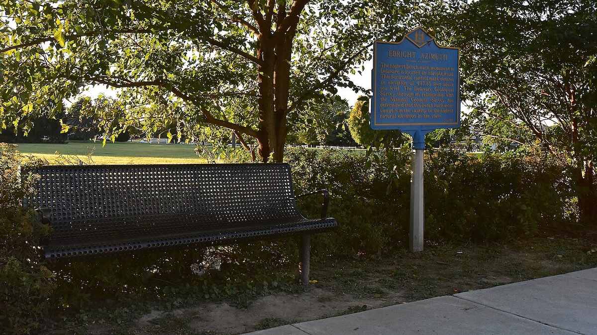
Delaware’s highest point, Ebright Azimuth, sits along Ebright Road in New Castle County, near Pennsylvania. At just 448 feet, it’s one of the lowest state high points. The spot is in a Wilmington neighborhood, marked by a small stone monument and a survey marker.
Don’t expect mountain views or a hike—this one’s a quick roadside stop. The marker is right near a mobile home park, but you can walk up and snap a photo. The area is pretty flat, so you won’t notice much of a climb. Still, Ebright Azimuth has its place on the highpointers’ checklist, and it’s a quirky reminder of Delaware’s low, coastal geography.
Florida: Britton Hill (345 feet)
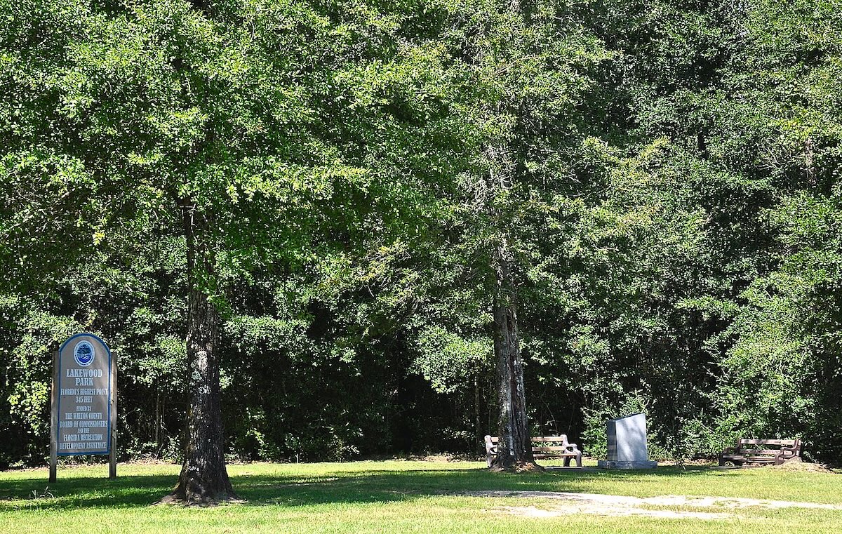
Florida’s high point, Britton Hill, is in the panhandle near the Alabama line, about an hour north of Panama City. At 345 feet, it’s the lowest high point in the country. You’ll find it in Lakewood Park, Walton County, and you can drive right up.
There’s a paved path to the summit marker, a monument, and some benches—honestly, you can visit in under ten minutes. Pine forests and gently rolling land surround the spot. Despite its low elevation, Britton Hill draws folks working through the 50-state list, and it’s definitely the easiest one to check off.
Georgia: Brasstown Bald (4,784 feet)
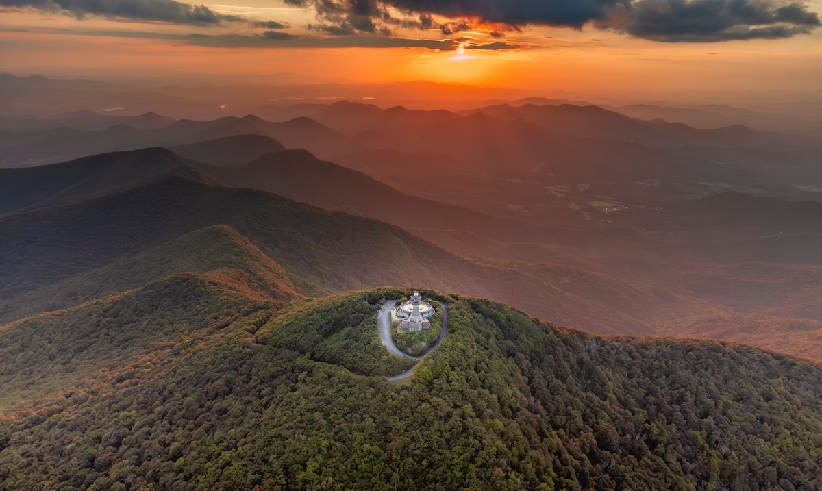
Georgia’s highest point, Brasstown Bald, rises to 4,784 feet in the Blue Ridge Mountains up north. It’s inside Chattahoochee National Forest, and the views are fantastic—on a clear day, you can see four states from the observation deck.
To reach the summit, there’s a paved half-mile trail climbing about 500 feet from the parking area, or you can hop a shuttle. At the top, you’ll find a visitor center with exhibits on the area’s ecology and history. The mountain’s name comes from a misinterpretation of a Cherokee word, and you’ll see interpretive signs, restrooms, and a viewing platform with sweeping views of the Appalachians.
Hawaii: Mauna Kea (13,803 feet)
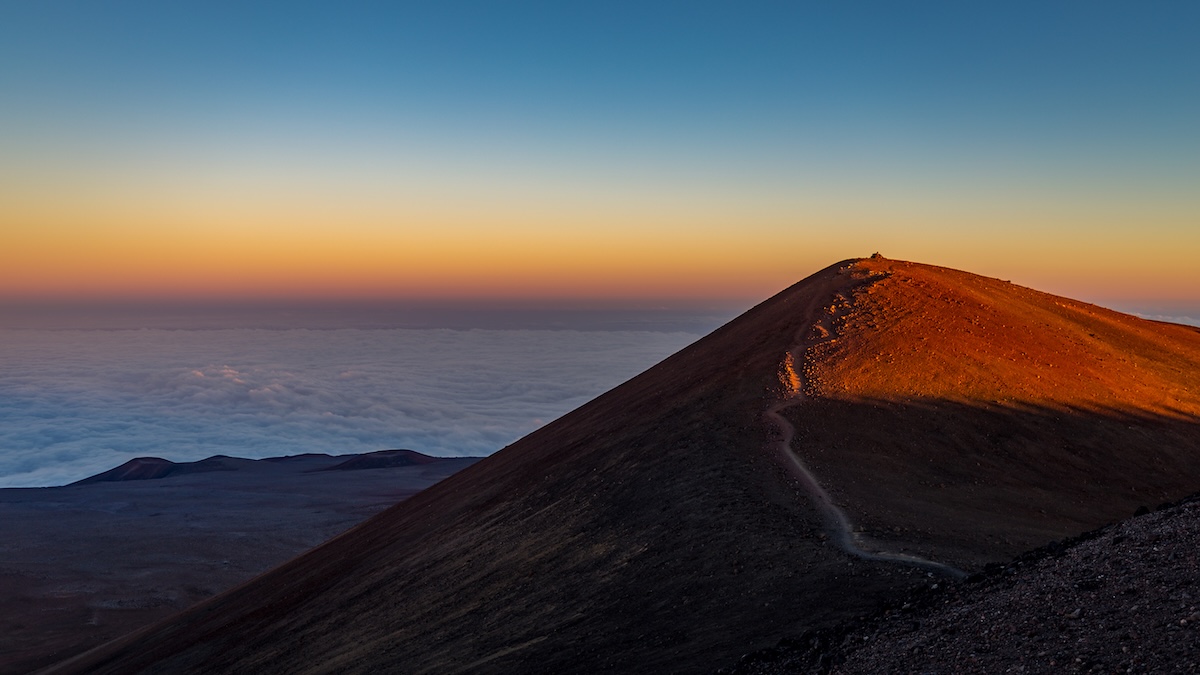
Mauna Kea, when measured from its ocean-floor base, is the world’s tallest mountain—over 33,000 feet. But its summit sits at 13,803 feet above sea level, making it Hawaii’s highest point. The dormant volcano dominates the Big Island, and “Mauna Kea” means “White Mountain,” a nod to the winter snow on top.
You can drive most of the way up, but the summit road is rough—you’ll need four-wheel drive and should take altitude seriously. The mountain’s home to world-class observatories thanks to its clear, dark skies. If you’re visiting, stop at the visitor station at 9,200 feet to acclimate; the thin air at the summit can sneak up on you.
Idaho: Borah Peak (12,662 feet)
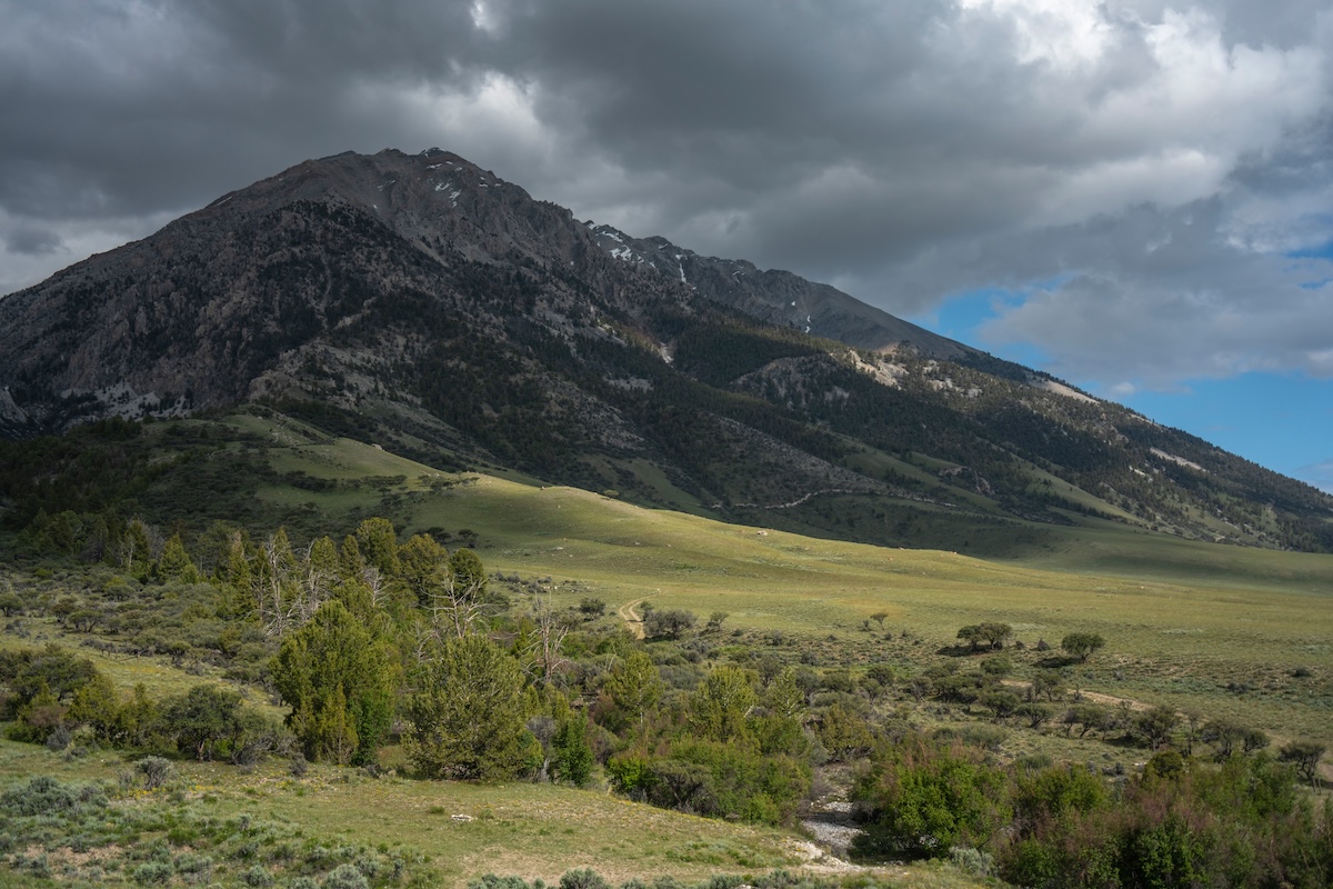
Idaho’s highest point, Borah Peak, rises out of the Lost River Range, about 20 miles north of Mackay. Climbers come here for a real challenge—steep trails and big elevation gain. The main route climbs about 5,300 feet over 3.5 miles, making it one of the tougher state high points in the Lower 48.
Most folks need 6 to 10 hours for the round trip, depending on fitness and how well you handle the altitude. One section, Chicken Out Ridge, is especially exposed and can be unnerving. July through September is usually best, after the snow melts. Start early to dodge afternoon thunderstorms—they’re common in summer. The trailhead sits at 7,400 feet, so acclimating helps.
Illinois: Charles Mound (1,235 feet)
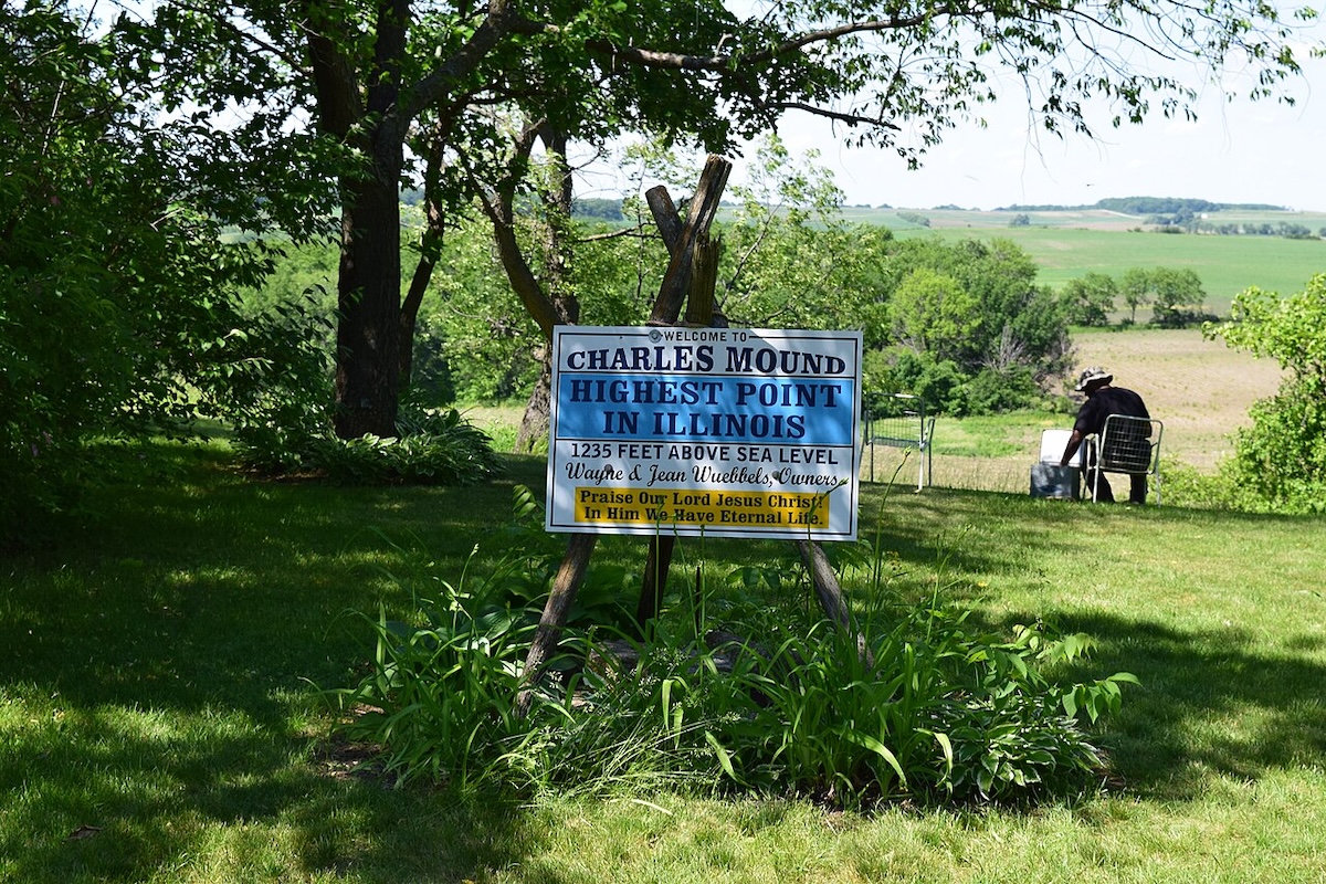
Illinois’ highest point, Charles Mound, sits in the far northwest corner near Wisconsin in Jo Daviess County. At 1,235 feet, it’s a gentle rise in a landscape mostly known for flat farmland. The summit’s on private land, so access depends on the owners.
The mound itself isn’t dramatic—just a soft bump in rolling countryside. If you do visit, you’ll see mostly fields and quiet rural views. There’s not much elevation gain, and no facilities or maintained trails. Highpointers need to plan ahead since it’s not always open to the public.
Indiana: Hoosier Hill (1,257 feet)
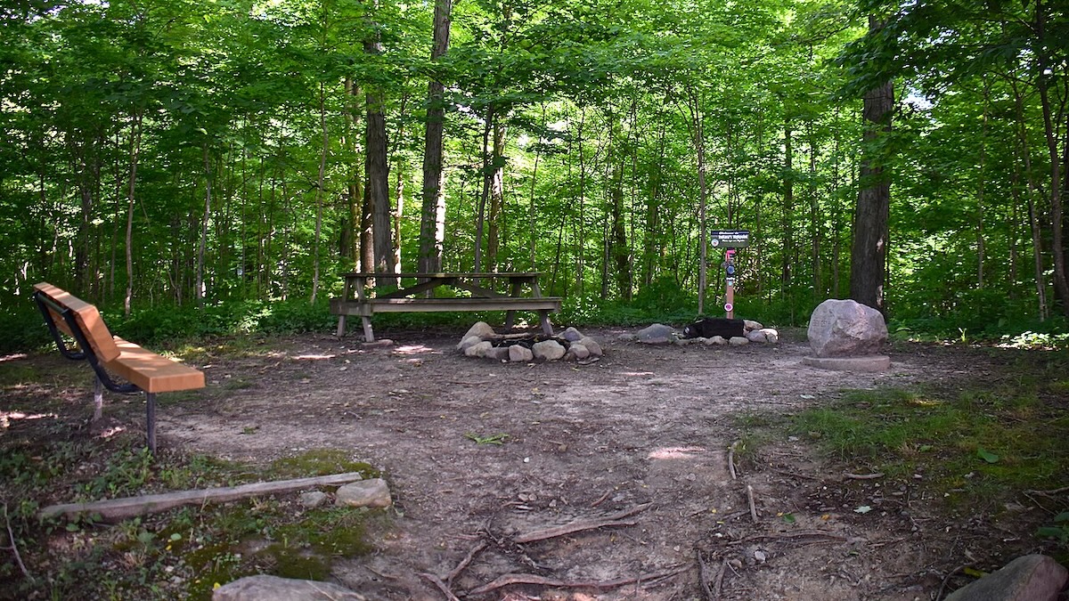
Indiana’s highest point is Hoosier Hill, found in Wayne County near the Ohio border, just outside Bethel. At 1,257 feet, it’s one of the lowest high points in the U.S., but it’s still Indiana’s top spot.
The landowners allow public access, and you’ll find a marker, picnic table, and a register to sign. The scenery is flat farmland, so don’t expect views or a workout. You can park right next to the marker and walk a few steps to the summit. It’s an easy stop for highpointers, and the locals keep the site tidy for visitors who want to stand at Indiana’s highest ground.
Iowa: Hawkeye Point (1,670 feet)
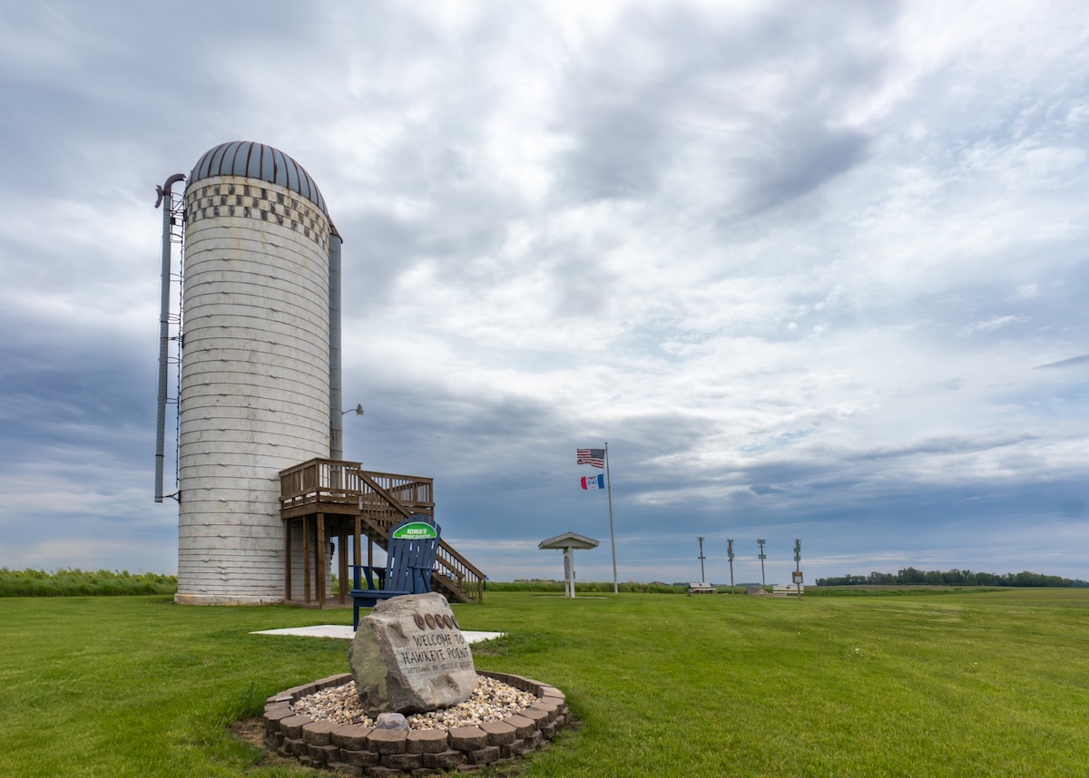
Iowa’s highest point hides out in the northwest corner near Sibley, rising to 1,670 feet. Honestly, you might not even notice you’re gaining elevation—just endless, gently rolling farmland in every direction.
When you get there, you’ll see a simple granite monument and an old concrete-block silo. The spot sits on private land, but the owners have been kind enough to let the public wander in for years. Don’t expect a dramatic peak or jaw-dropping view—just the quiet, everyday charm of Iowa’s farm country. Snap a photo at the marker, take a breath, and enjoy the peacefulness. Most folks only spend a few minutes here, so it’s an easy stop if you’re passing through or chasing state high points.
Kansas: Mount Sunflower (4,039 feet)
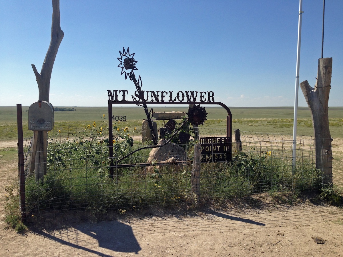
Kansas’s highest point is right near the Colorado border in Wallace County. Mount Sunflower reaches 4,039 feet, though “mountain” is a stretch—it’s just a gentle rise in the endless High Plains. The site sits on private ranch land, but the owners are welcoming and let folks visit.
You’ll spot a sunflower sculpture and a concrete monument marking the exact spot. The area opens up into classic western Kansas prairie—flat, a bit rolling, and wide open. You can drive up a dirt road all the way to the summit, so this is about as easy as state high points get. No hiking, no sweating—just pull up, hop out, and grab a photo at the marker.
Kentucky: Black Mountain (4,145 feet)
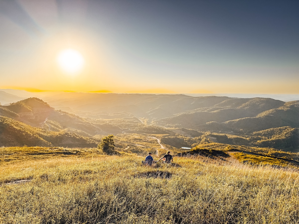
Kentucky’s highest point sits tucked in the far southeast corner, right on the Virginia border in Harlan County. Black Mountain climbs to 4,145 feet, surrounded by the rugged Cumberland Mountains—a region with deep coal mining roots and classic Appalachian scenery.
Reaching the summit takes a little planning, since the mountain’s mostly on private land. There’s a gravel road to the top, but you’ll usually need to arrange access ahead of time. The peak rewards you with long views over forested ridges stretching into Virginia and eastern Kentucky. It’s not a busy spot, so you’ll get a real taste of Appalachian Kentucky away from tourist crowds.
Louisiana: Driskill Mountain (535 feet)
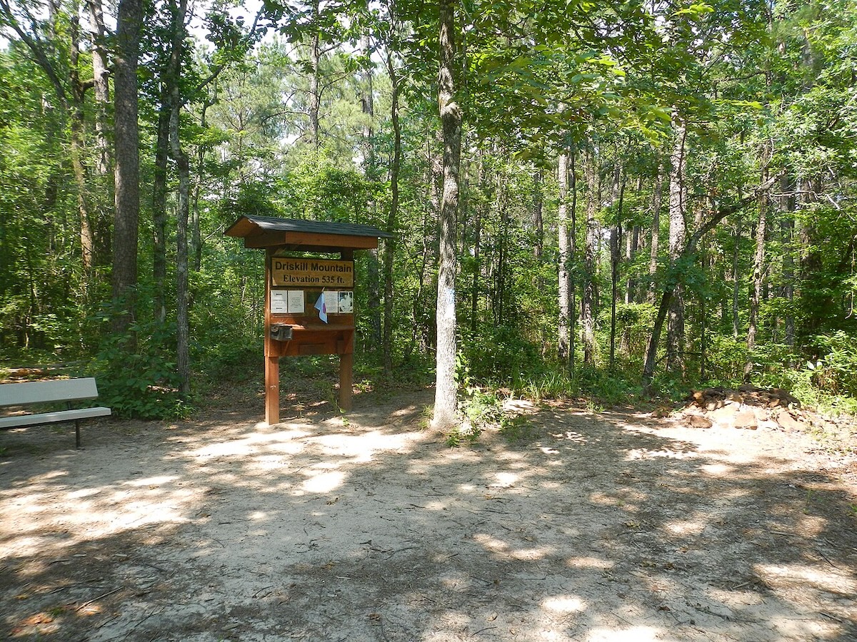
Louisiana’s highest point is in Bienville Parish—Driskill Mountain, which rises just 535 feet. Despite the name, it’s really more of a hill, fitting for a state that’s mostly flat and swampy. The summit’s on private land, but public access is generally allowed during daylight.
Visiting Driskill Mountain is a low-key affair. There’s a short, easy trail through pine woods that leads to the summit marker. You’ll reach the top in just a few minutes from the parking area, making this one of the easiest state high points out there. There aren’t sweeping views or dramatic climbs, but the quiet woods and the novelty of being at Louisiana’s highest natural point are worth the stop.
Maine: Mount Katahdin (5,269 feet)
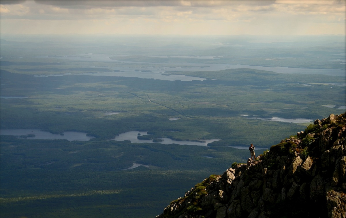
Maine’s highest point towers over Baxter State Park—Mount Katahdin, the northern end of the Appalachian Trail. For thru-hikers, this is the finish line after 2,000+ miles. Katahdin means “greatest mountain” in Penobscot, and honestly, it earns the name with its rugged granite and wild weather.
If you’re aiming for the summit, plan for a tough day hike—usually 8 to 12 hours round trip. The Hunt Trail is the most popular, following the Appalachian Trail and including the Knife Edge, a narrow, exposed ridge that’s not for the faint of heart. You’ll want to start early, check the weather, and remember that the park enforces strict turnaround times and trail closures when things get dicey. Hiking season runs late May to mid-October, and you’ll need reservations for parking and camping.
Maryland: Hoye-Crest (3,360 feet)
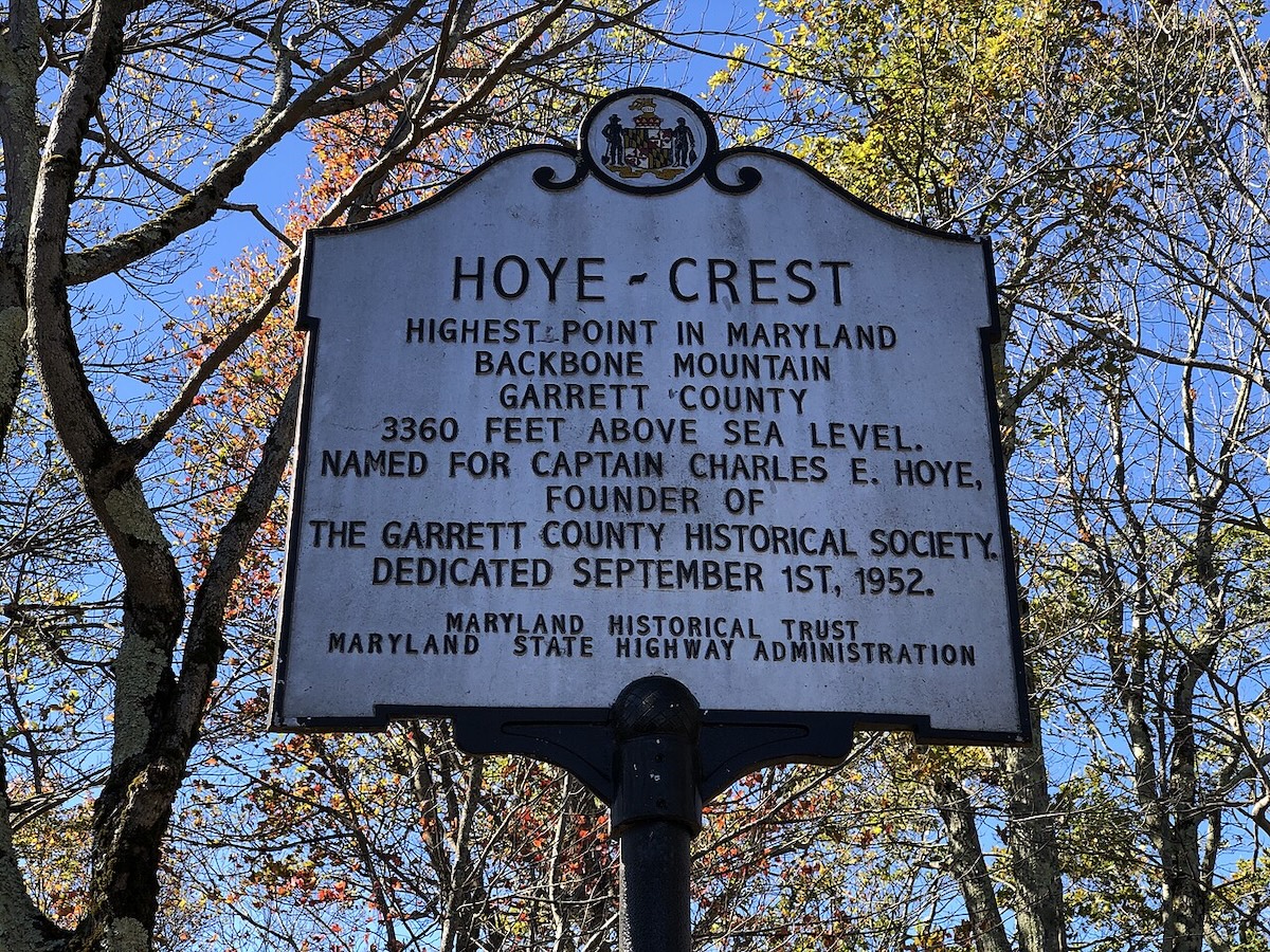
Maryland’s highest point is hidden in Garrett County, right near the West Virginia line. Hoye-Crest sits atop Backbone Mountain at 3,360 feet, inside the Savage River State Forest—a big patch of wilderness with year-round hiking.
At the summit, you’ll find a small stone marker. The area is thickly forested, so don’t expect big views from the top. Trails wind through the woods, and the hike isn’t too long or difficult for most people. Up here, it’s cooler than the rest of Maryland, and snow isn’t unusual in winter. Deep Creek Lake and a handful of state parks are close by, so you’ve got plenty of options if you want to explore more of western Maryland’s hills.
Massachusetts: Mount Greylock (3,491 feet)
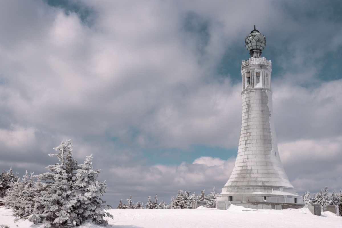
Massachusetts’ highest peak rises in the state’s northwest corner—Mount Greylock, topping out at 3,491 feet in the Berkshires. On clear days, the summit gives you views across five states, and you can drive most of the way up a winding, forested road.
At the top stands the unmistakable Massachusetts Veterans War Memorial Tower, a 93-foot granite landmark from 1933. The mountain is inside Mount Greylock State Reservation, with over 70 miles of hiking trails, including a slice of the Appalachian Trail right over the summit. If you want to linger, check out Bascom Lodge, a rustic stone building that’s been hosting hikers since the 1930s, or try one of the campsites nearby.
Michigan: Mount Arvon (1,979 feet)
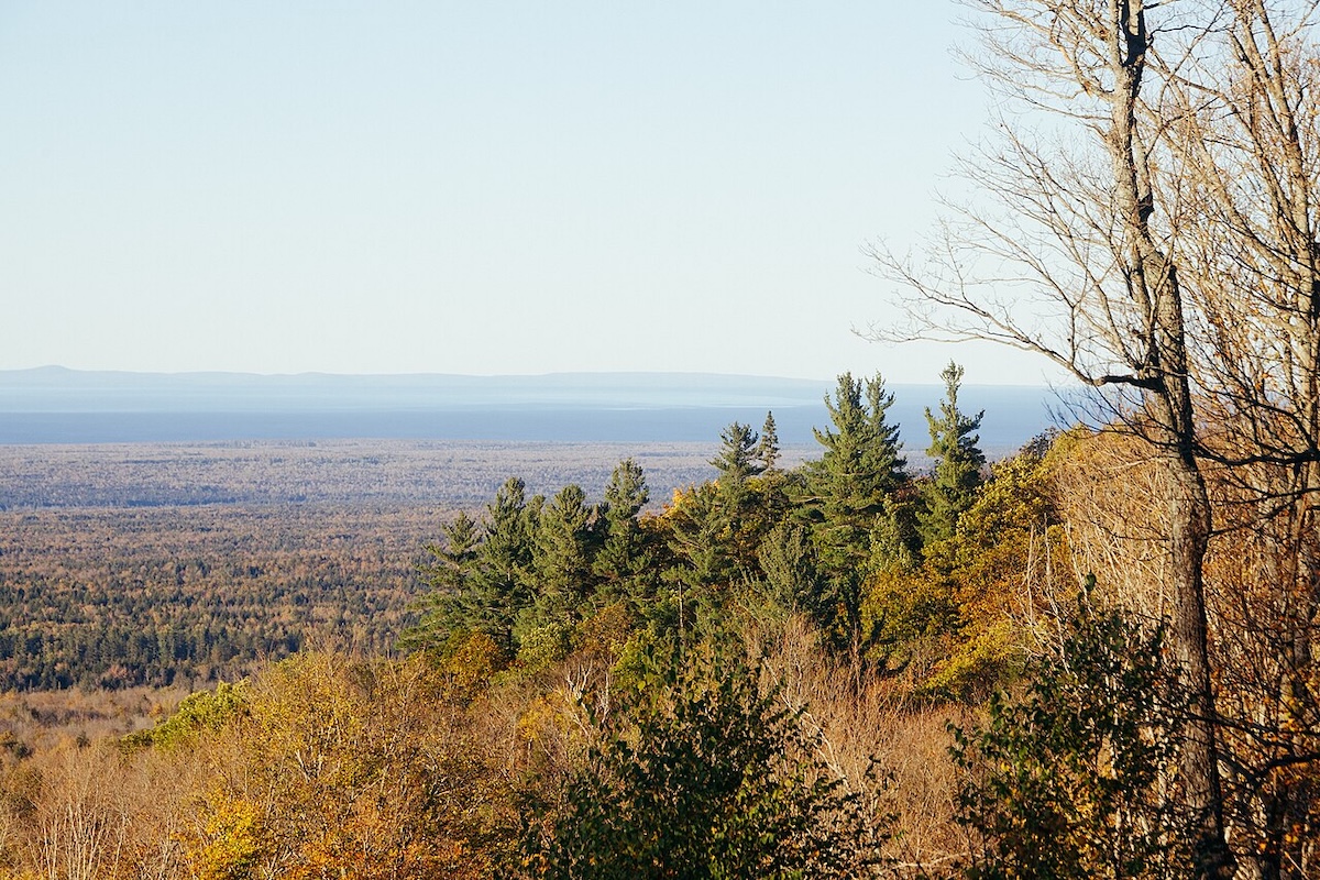
Michigan’s highest point nestles in the Huron Mountains of the Upper Peninsula, about 27 miles from Marquette. Mount Arvon stands at 1,979 feet, though for years, folks assumed nearby Mount Curwood was taller—until a 1982 survey settled the score.
Getting there means driving rough dirt roads, which can get tricky after rain. The summit is deep in the woods, surrounded by hardwoods and pines, so don’t expect big views or rocky peaks. A small wooden sign and USGS marker let you know you’ve made it. It’s pretty remote and undeveloped, so if you’re after a backcountry feel, this is Michigan’s wild side at its best.
Minnesota: Eagle Mountain (2,301 feet)
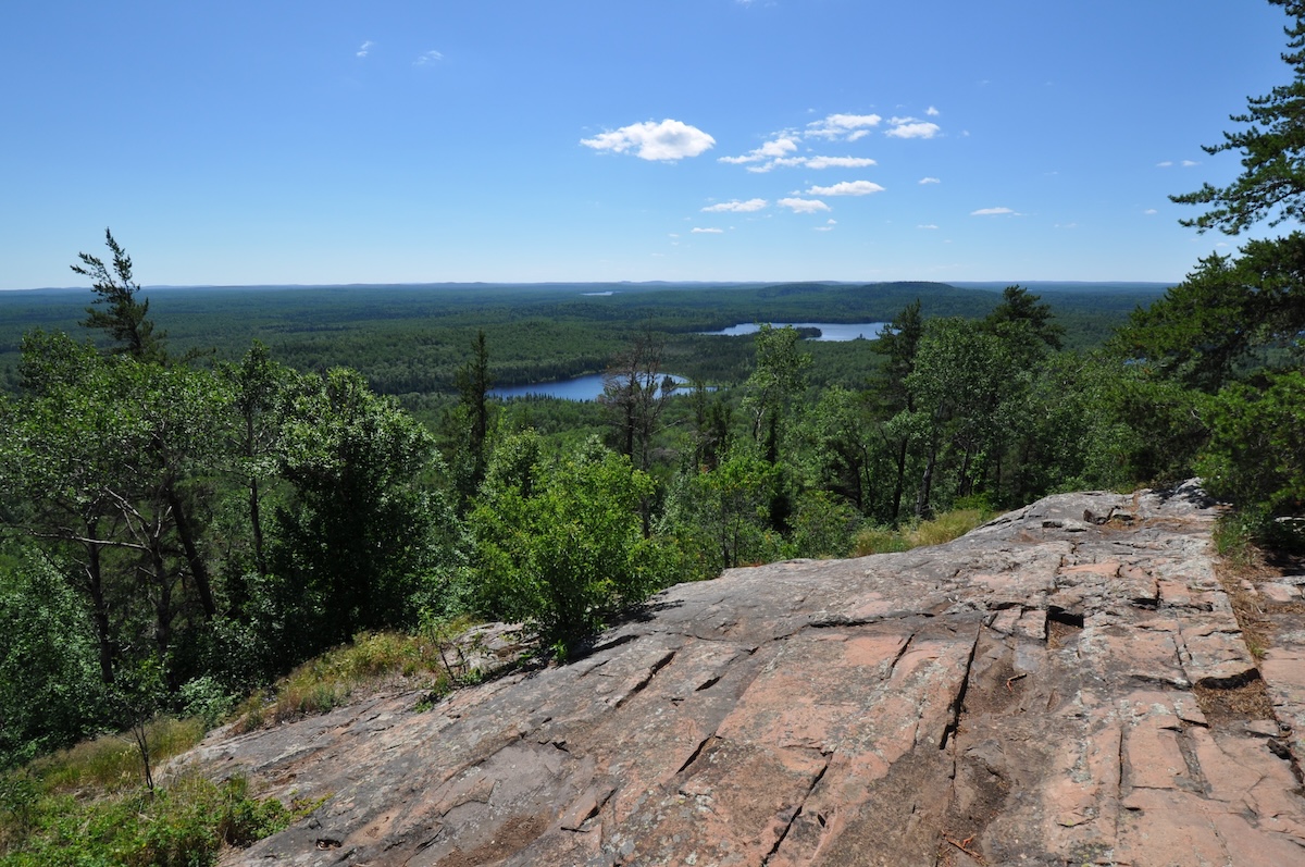
Minnesota’s highest point is tucked into Superior National Forest, way up near the Canadian border. Eagle Mountain climbs to 2,301 feet, and the hike up takes you through dense northern woods. The summit is just a few miles from Lake Superior, and the landscape shifts from prairie to boreal forest as you head north.
The trail is about 3.5 miles one way. You’ll pass quiet lakes like Whale and Brule—great if you want to camp out. The hike is moderately tough, with some rocky patches and steady climbing, but nothing too technical for most hikers. At the top, trees block out sweeping views, but you’ll find a plaque marking the spot. Fall is especially gorgeous here, when the hardwoods light up in color against the evergreens.
Mississippi: Woodall Mountain (807 feet)
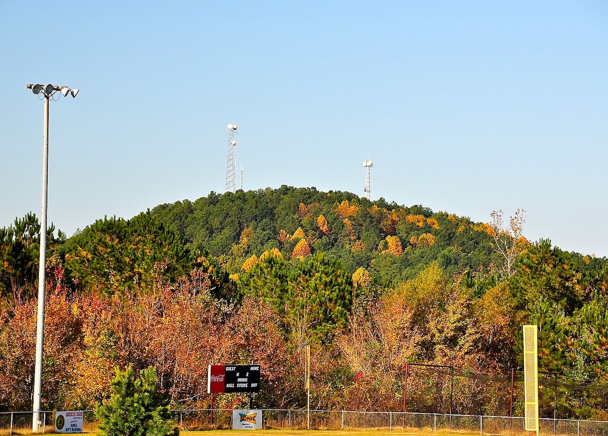
Mississippi’s highest point sits in the northeast, near Iuka in Tishomingo County. Woodall Mountain reaches just 807 feet, so it’s one of the lowest state high points, but it gives you a different look at Mississippi’s rolling hills and forests.
It’s easy to reach—just drive up the paved road almost to the top. There’s a communications tower and a small parking area near the summit. No hiking needed, so it’s a quick stop if you’re passing through northern Mississippi. The landscape here isn’t what most people picture when they think of Mississippi—it’s hillier and more varied than the flat Delta country.
Missouri: Taum Sauk Mountain (1,772 feet)
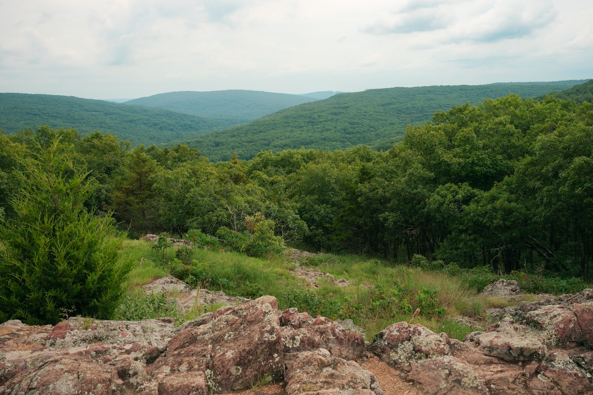
Missouri’s highest point rises in the St. Francois Mountains of the Ozarks, about 90 miles south of St. Louis. Taum Sauk Mountain reaches 1,772 feet, and while it’s not exactly towering, it offers a different kind of high-point experience. The summit is inside Taum Sauk Mountain State Park, and a short, easy trail leads you right up.
Around the summit, you’ll find rocky glades and hardwood forests typical of the Ozarks. There’s not much elevation gain since the surrounding area is pretty high already, so it’s an accessible spot. The park connects to the Taum Sauk Trail, which leads to Mina Sauk Falls—the tallest waterfall in Missouri at 132 feet. If you’re collecting high points, this is a quick one to check off, and you can easily explore more of the Ozarks while you’re there.
Montana: Granite Peak (12,799 feet)
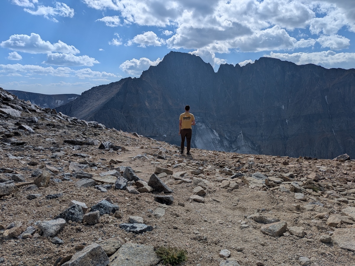
Montana’s highest point towers in the Beartooth Range near the Wyoming border. Granite Peak stands at 12,799 feet and is one of the toughest state high points in the lower 48. This isn’t a casual hike—you’ll need real mountaineering chops for the exposed Class 4 scrambling and rockfall hazards.
Most folks spend two or three days on the climb, starting from a trailhead near Cooke City. You’ll navigate glaciers, loose rock, and a grueling 7,000+ feet of elevation gain. The weather changes fast up here, and snow can stick around well into summer. Most climbers aim for late July through early September, but storms and cold can hit any time at altitude.
Nebraska: Panorama Point (5,424 feet)
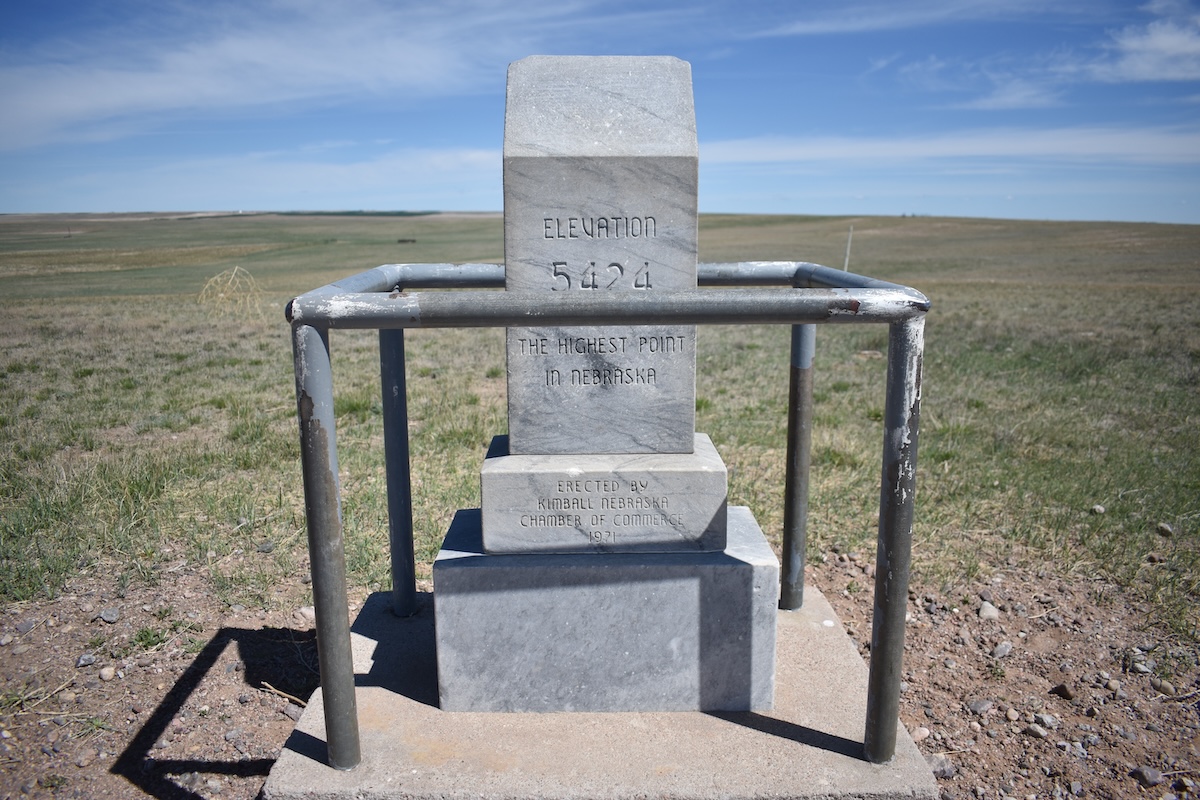
Nebraska’s highest point is way out in the far southwest, almost at the Colorado and Wyoming borders. Panorama Point sits in Kimball County, where the High Plains gradually slope up toward the Rockies. The rise is so gentle, you might not even realize you’re at the state’s peak.
You’ll find a simple stone marker and a plaque at the spot. The prairie stretches out in every direction—just endless farmland and grassland. It’s easy to reach by car, and the area is quiet and undeveloped, keeping its rural vibe intact.
Nevada: Boundary Peak (13,147 feet)
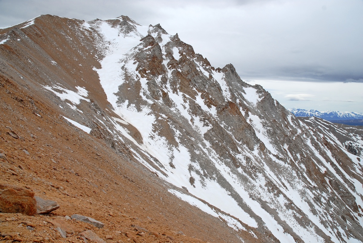
Nevada’s highest point sits in the White Mountains on the California border, about 65 miles southeast of Lake Tahoe. Boundary Peak gets its name from its spot on the state line, though the summit is fully in Nevada. Funny enough, it’s technically a sub-peak of Montgomery Peak, which is just a bit taller over in California.
The usual route starts at Trail Canyon trailhead. It’s a tough 8-mile round trip with over 4,000 feet of climbing. You’ll hike through high-desert terrain—think sparse brush and rocky slopes. The best time to go is late June through October, after the snow melts. Not many people make the trek, so you’ll likely have the place to yourself. Summer storms can roll in fast, so start early and bring more water than you think you’ll need.
New Hampshire: Mount Washington (6,288 feet)
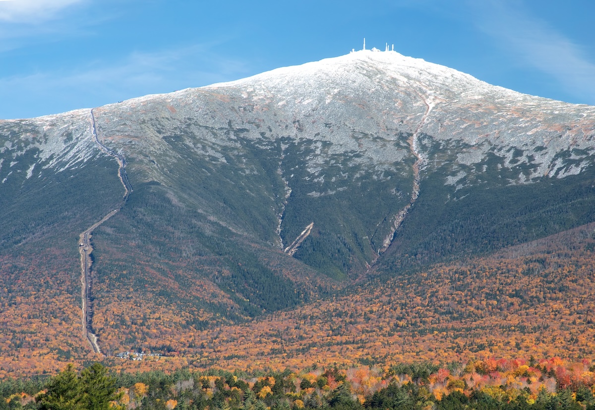
Mount Washington rules the Presidential Range in New Hampshire’s White Mountains, easily the most prominent peak in the Northeast. It’s famous for wild weather—231 mph winds were clocked here in 1934, and even in summer, it can feel downright arctic at the summit.
You’ve got options to reach the top: the steep Tuckerman Ravine Trail, the historic Mount Washington Auto Road (open since 1861), or the classic Cog Railway, which has been chugging up since 1869. At the summit, you’ll find the Mount Washington Observatory and visitor center, where you can dig into the mountain’s extreme weather and scientific history.
New Jersey: High Point (1,803 feet)
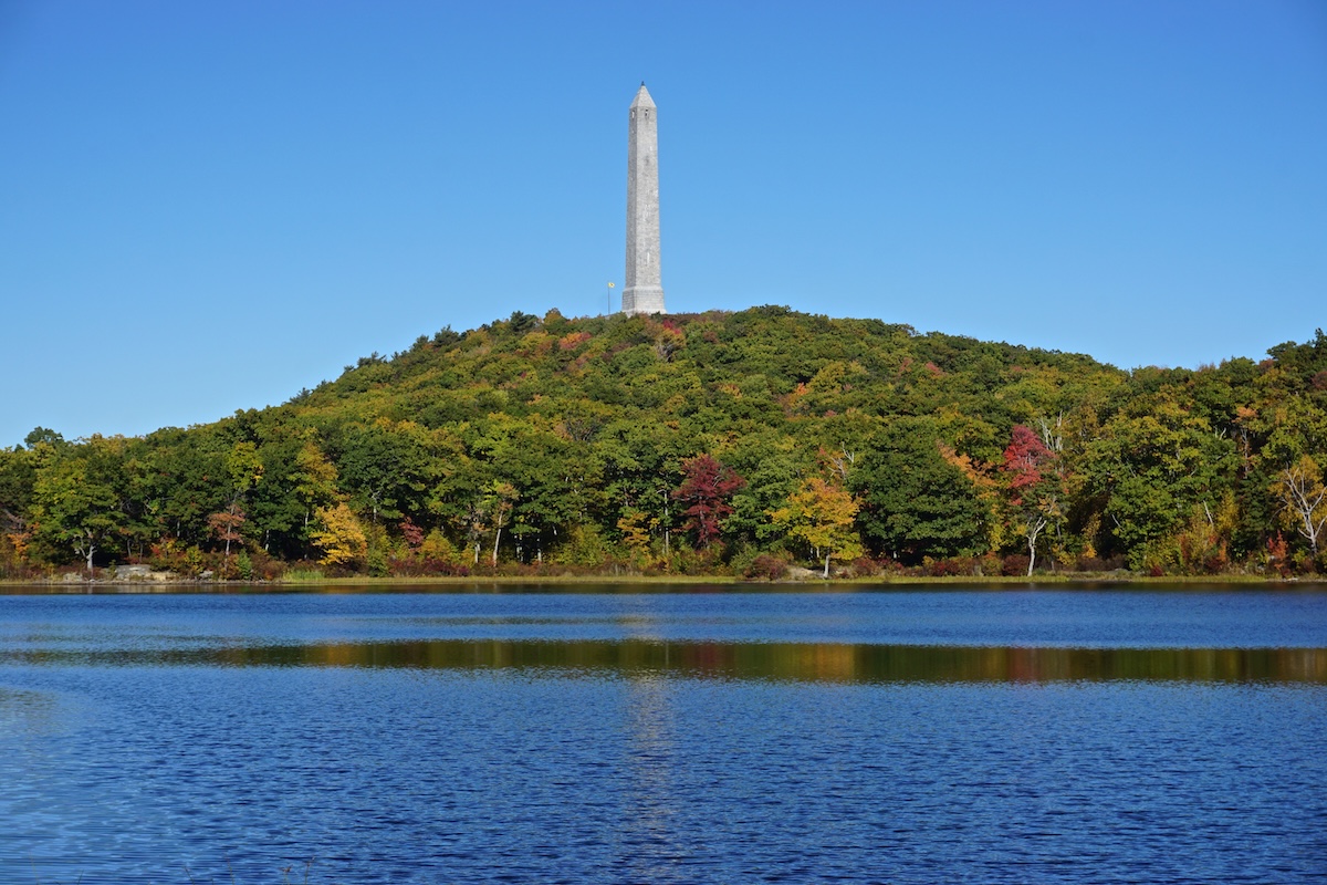
New Jersey’s High Point, true to its name, rises 1,803 feet above sea level in the state’s northwestern corner. It’s tucked in High Point State Park in Sussex County, right along the Kittatinny Ridge where New Jersey, New York, and Pennsylvania almost meet. On a clear day, you get broad views across all three states, which is impressive—even if the elevation isn’t exactly Rocky Mountain-level.
At the summit, a 220-foot monument, built in 1930 to honor New Jersey’s war veterans, towers above the landscape. During the warmer months, you can climb to the top of this obelisk for an even better vantage point. The park itself sprawls over 15,000 acres, laced with hiking trails—including a stretch of the Appalachian Trail. In summer, people swim in the spring-fed lake, and fall brings a riot of color to the ridge. In winter, the area draws cross-country skiers and snowshoers.
New Mexico: Wheeler Peak (13,161 feet)
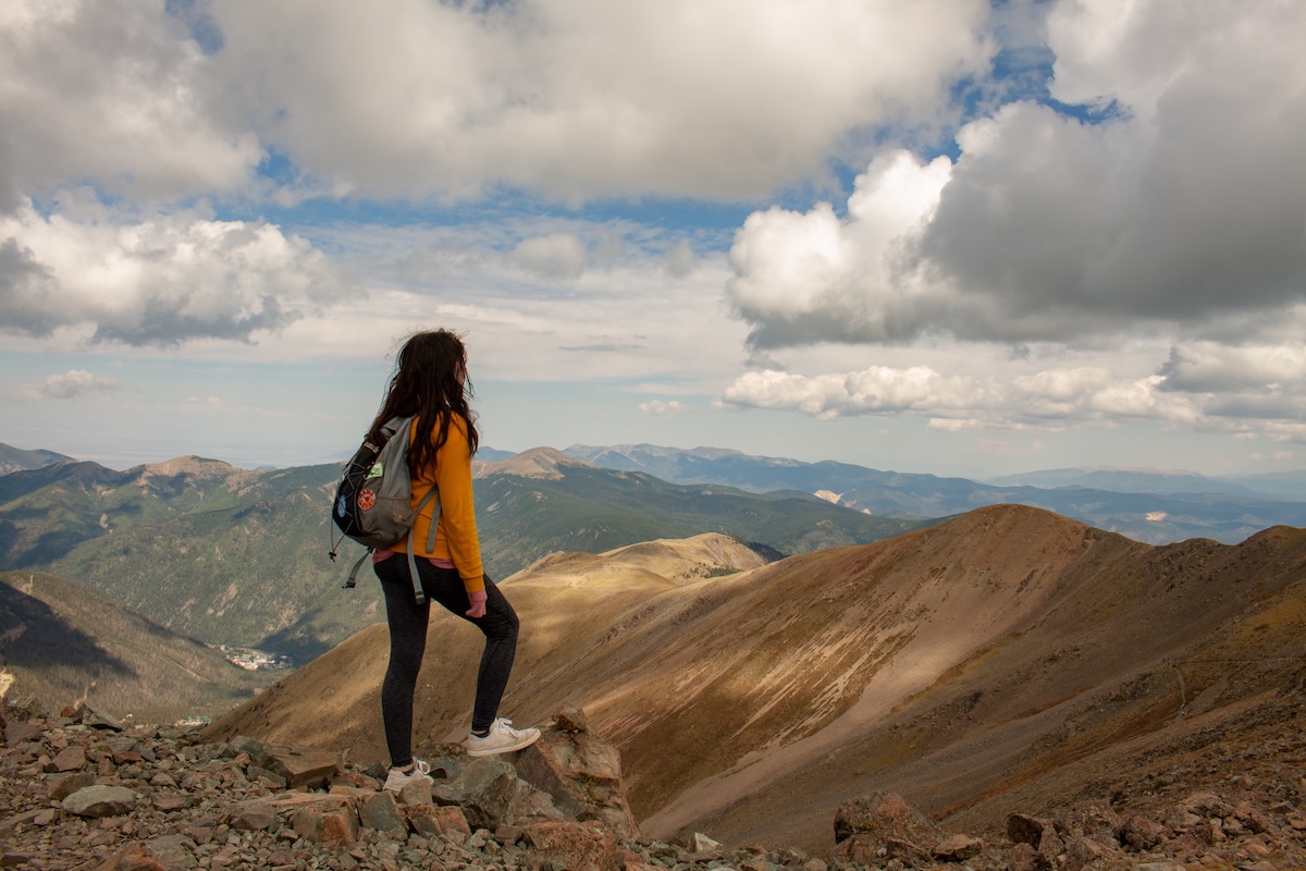
New Mexico’s highest point, Wheeler Peak, hides out in the Sangre de Cristo Mountains, just north of Taos. At 13,161 feet, it’s a challenging climb but worth every step for the scenery. Most hikers start from the Taos Ski Valley trailhead, facing about 8 miles round trip and a 3,000-foot elevation gain. You’ll wind through thick spruce and fir forests before breaking out above the treeline.
Plan for 6 to 8 hours on the trail, and start early to dodge those notorious afternoon thunderstorms in summer. At the top, the views stretch deep into northern New Mexico and even Colorado. The altitude makes things tough, so acclimatizing is a good idea. Late June to September usually brings the best conditions, though snow sometimes hangs around up high well into summer. Mountain weather changes fast, so come prepared and carry plenty of water.
New York: Mount Marcy (5,344 feet)
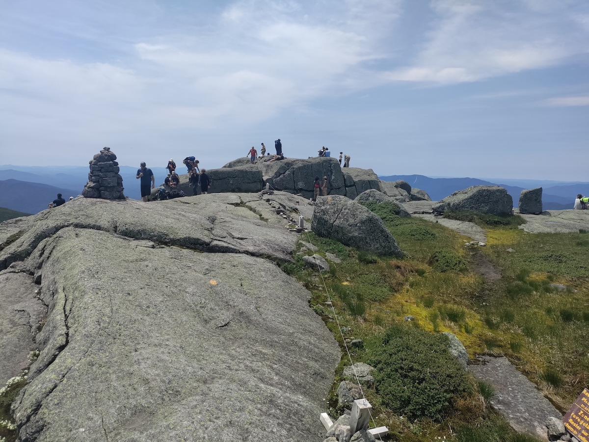
New York’s highest summit, Mount Marcy, sits deep in the Adirondacks at 5,344 feet. Named for former governor William L. Marcy, the peak pulls thousands of hikers to its rocky top every year. It anchors the High Peaks Wilderness Area, right in the heart of one of the Northeast’s most scenic spots.
Most folks start at the Adirondack Loj near Lake Placid, following a roughly 15-mile round-trip trail with over 3,000 feet of climbing. The trek usually takes 7 to 10 hours, depending on your speed and the trail’s mood that day. You’ll pass through thick forests, splash across streams, and finally reach the open, wind-swept summit. On a good day, you can see Vermont, Canada, and a sea of Adirondack peaks. Late spring through early fall is the sweet spot for hiking, but honestly, the weather up there does what it wants.
North Carolina: Mount Mitchell (6,684 feet)
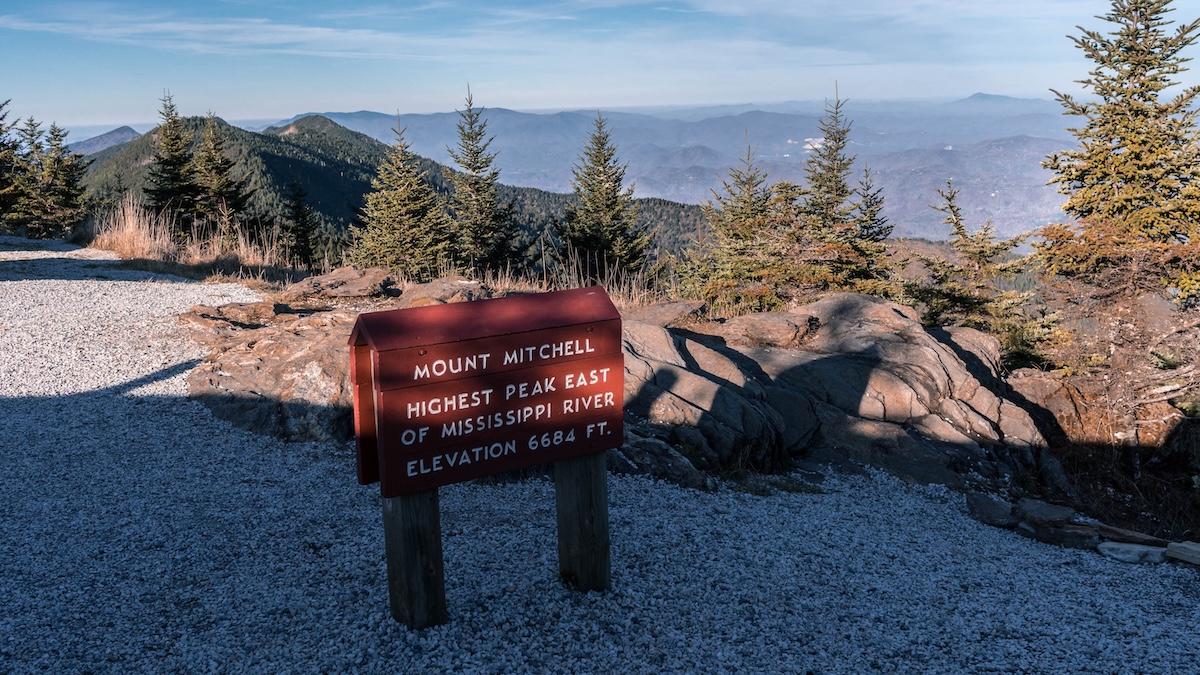
Mount Mitchell claims the title of highest peak east of the Mississippi, making it a big deal in the Appalachians. You’ll find it in Mount Mitchell State Park, about 35 miles northeast of Asheville. Elisha Mitchell, the mountain’s namesake, measured its height in the 1830s and, in a sad twist, died on its slopes in 1857.
You can drive almost to the top—there’s a paved road to a parking lot just below the summit. From there, a short but steep trail gets you to the observation tower. On a clear day, the views stretch out for more than 85 miles. The summit’s climate feels more Canadian than Southern, with temperatures averaging about 50 degrees cooler than the valleys. The spruce-fir forest up top adds to the northern vibe.
North Dakota: White Butte (3,506 feet)
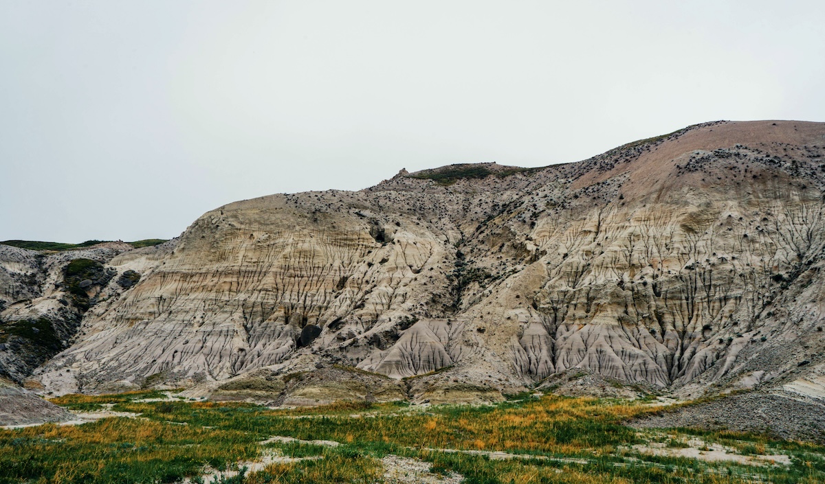
White Butte, at 3,506 feet, is North Dakota’s highest natural point. It sits in the state’s southwestern corner, nestled in the Badlands near Amidon. The butte rises gently from the prairie, and the hike up is pretty approachable.
You’ll spend about an hour on a well-marked, 1.5-mile round-trip trail. The climb is mild, with moderate elevation gain. From the summit, you get wide-open views of the North Dakota plains and the rugged Badlands. The land is privately owned, but the family allows public access—just stick to the trail and respect the posted rules. Spring through fall is the best window for a visit, thanks to decent weather.
Ohio: Campbell Hill (1,549 feet)
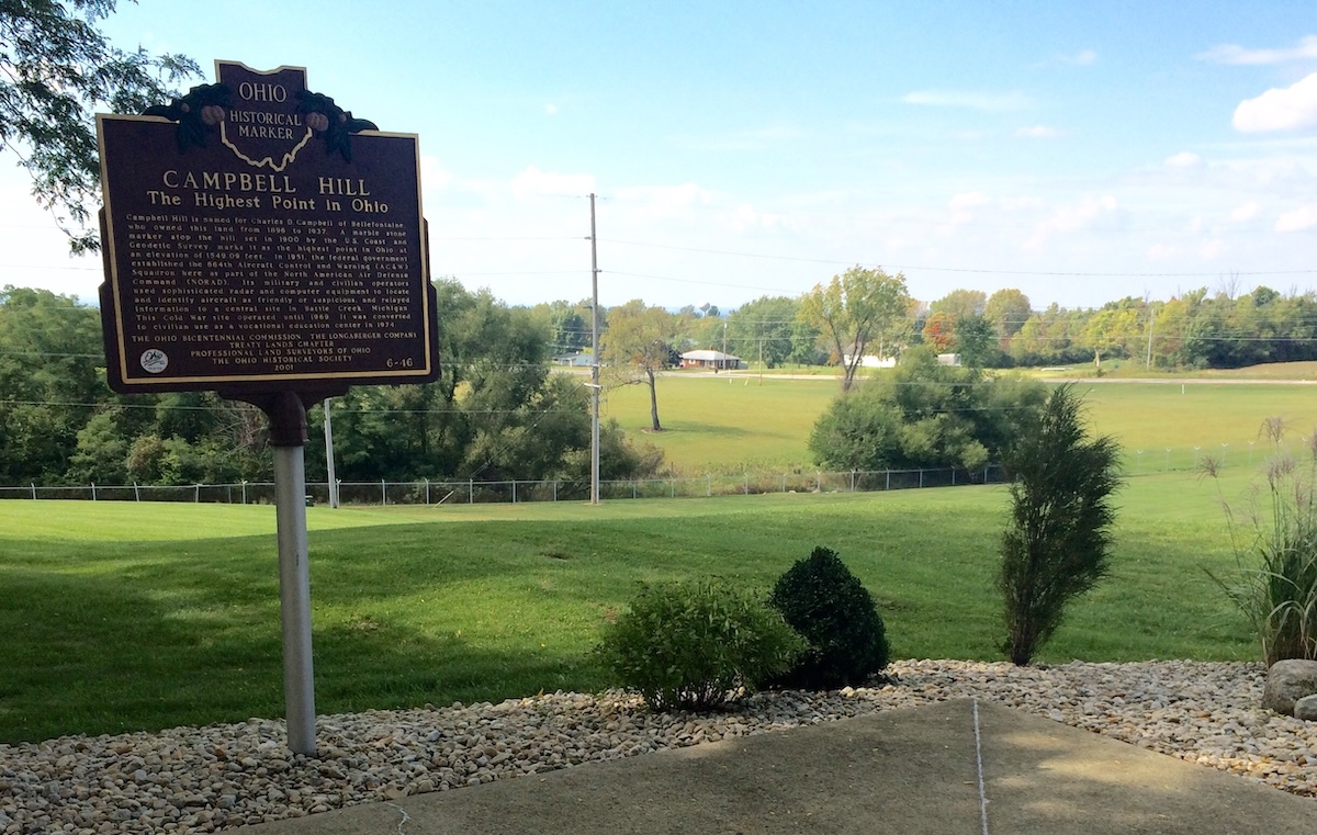
Ohio’s highest point is a bit unexpected—it’s tucked into a cemetery in Bellefontaine. Campbell Hill rises to 1,549 feet, making it one of the country’s more modest high points. The summit sits on Hi-Point Career Center property, right next to the Bellefontaine Cemetery, with a few graves marking the exact spot.
It’s easy to visit. There’s a survey marker and a small monument noting the high point. The surrounding area is flat and pretty developed, so don’t expect mountain vistas. Instead, you get a sense of Ohio’s glacier-flattened landscape. Campbell Hill might not be dramatic, but it’s the Buckeye State’s highest natural spot.
Oklahoma: Black Mesa (4,973 feet)
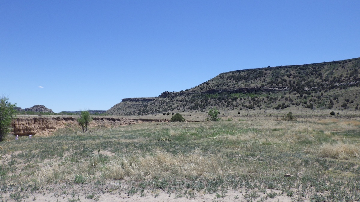
Oklahoma’s highest point, Black Mesa, rises to 4,973 feet in the far-flung panhandle. This flat-topped mesa sits at the state’s western tip, right where Oklahoma, Colorado, and New Mexico meet. The formation is actually part of an ancient lava flow from a long-gone volcanic field.
The trail to the top is about 8.5 miles round trip, with a gentle 750-foot elevation gain. You’ll cross open grasslands and pass some striking rock formations. The route is well-marked and pretty manageable for most hikers with some stamina. At the summit, a monument marks the high point, and the sweeping views take in three states. The area around Black Mesa is loaded with wildlife and feels different from the rolling plains most folks picture when they think of Oklahoma.
Oregon: Mount Hood (11,249 feet)
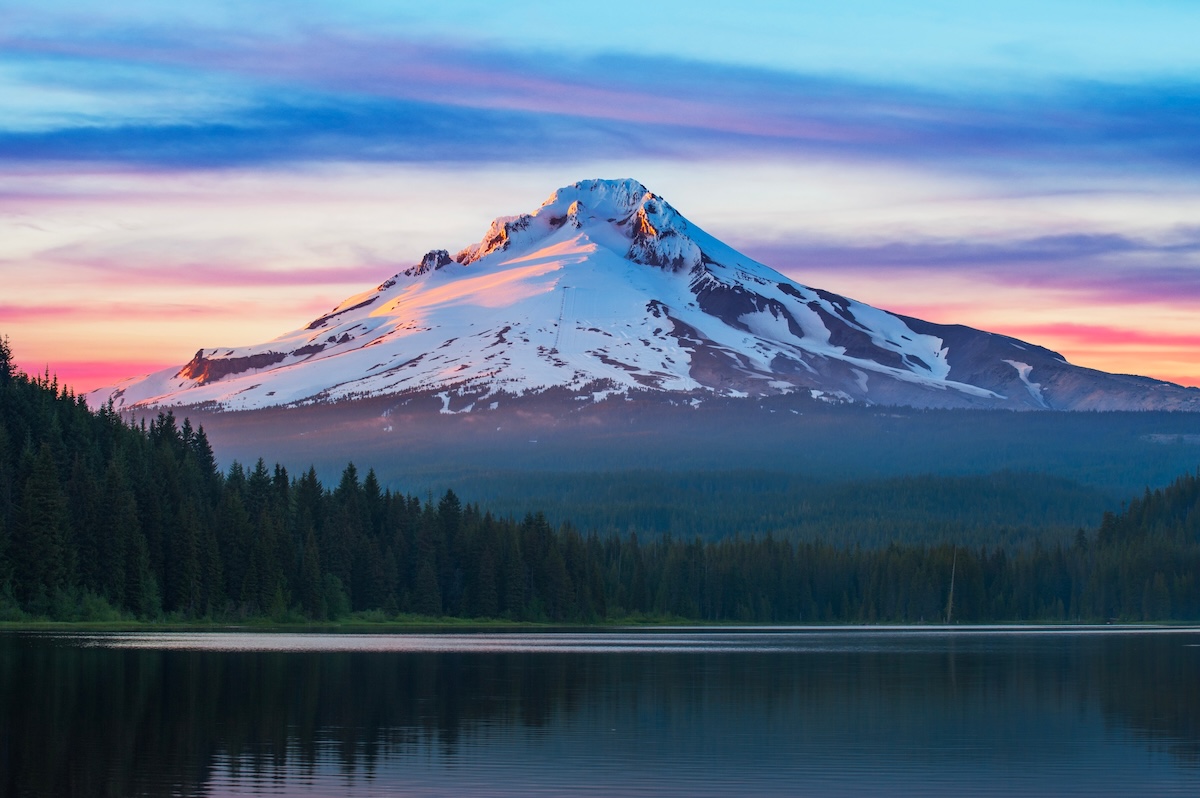
Mount Hood, Oregon’s tallest peak, rises 11,249 feet in the Cascade Range, just 50 miles east of Portland. It’s an active stratovolcano, though its last major eruption was way back in the 1790s.
Several climbing routes reach the top, but the south side is the classic choice for most mountaineers. The climb calls for glacier travel and ice axe skills—there are eleven glaciers draped across the mountain. If you’re not up for summiting, you can still drive up to Timberline Lodge at 6,000 feet, where there’s skiing even in summer. Over 10,000 people try for the summit each year, making Mount Hood one of the most-climbed major peaks anywhere—second only to Mount Fuji.
Pennsylvania: Mount Davis (3,213 feet)
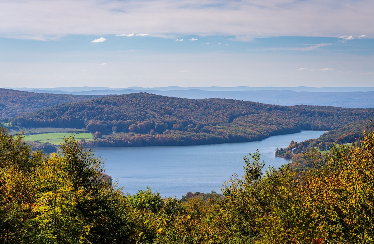
Pennsylvania’s highest point, Mount Davis, stands at 3,213 feet near the Maryland border in Somerset County. It’s tucked into Forbes State Forest and somehow manages to feel remote despite the state’s crowded reputation. The summit was named for John Nelson Davis, a Civil War veteran and local surveyor who once owned the land.
You can climb a 50-foot observation tower for panoramic views across the Alleghenies. Several trails weave through the hardwood forests, and the air feels cooler than elsewhere in Pennsylvania. There’s a picnic area and some primitive camping if you want to linger. Unlike some state high points, you can almost drive to the top—just a short walk from the parking lot.
Rhode Island: Jerimoth Hill (812 feet)
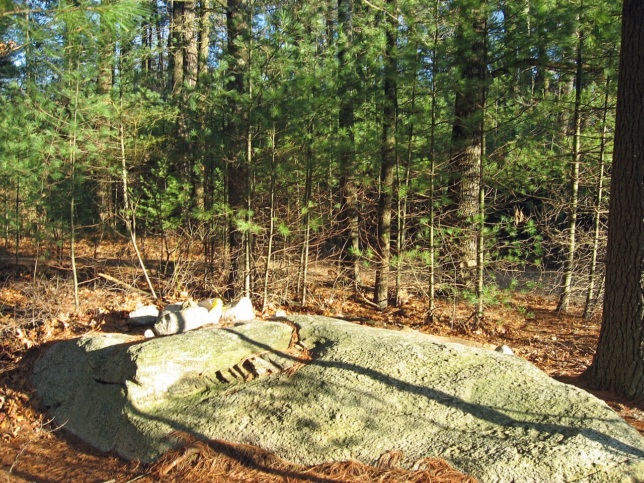
Rhode Island’s highest point, Jerimoth Hill, sits at 812 feet in the northwest corner near Connecticut. It’s the lowest state high point in the country, and the summit itself is on flat, wooded ground in Foster—so don’t expect any jaw-dropping climb.
For years, access to Jerimoth Hill was tricky because of a property dispute, but that got sorted out in the early 2000s. Now, you can stroll a short, easy path from a parking area on Route 101. A rock marker notes the spot. The woods keep views limited, but hey—it’s the top of the Ocean State.
South Carolina: Sassafras Mountain (3,560 feet)
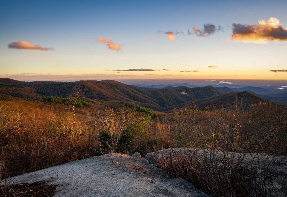
Sassafras Mountain, at 3,560 feet, marks South Carolina’s highest point in the state’s far northwest, right on the North Carolina border. The peak sits in the Blue Ridge Mountains and serves up rewarding views across several states when the weather’s clear. You can reach the summit via a short trail from the parking lot, so it’s accessible to just about anyone.
There’s an observation tower up top to boost the already impressive vistas. In recent years, the area’s become more visitor-friendly, with better facilities and trails. Sassafras Mountain is part of the Jocassee Gorges region, which is famous for its biodiversity and rugged beauty. Spring and fall offer the best hiking conditions, but visitors show up year-round.
South Dakota: Black Elk Peak (7,242 feet)
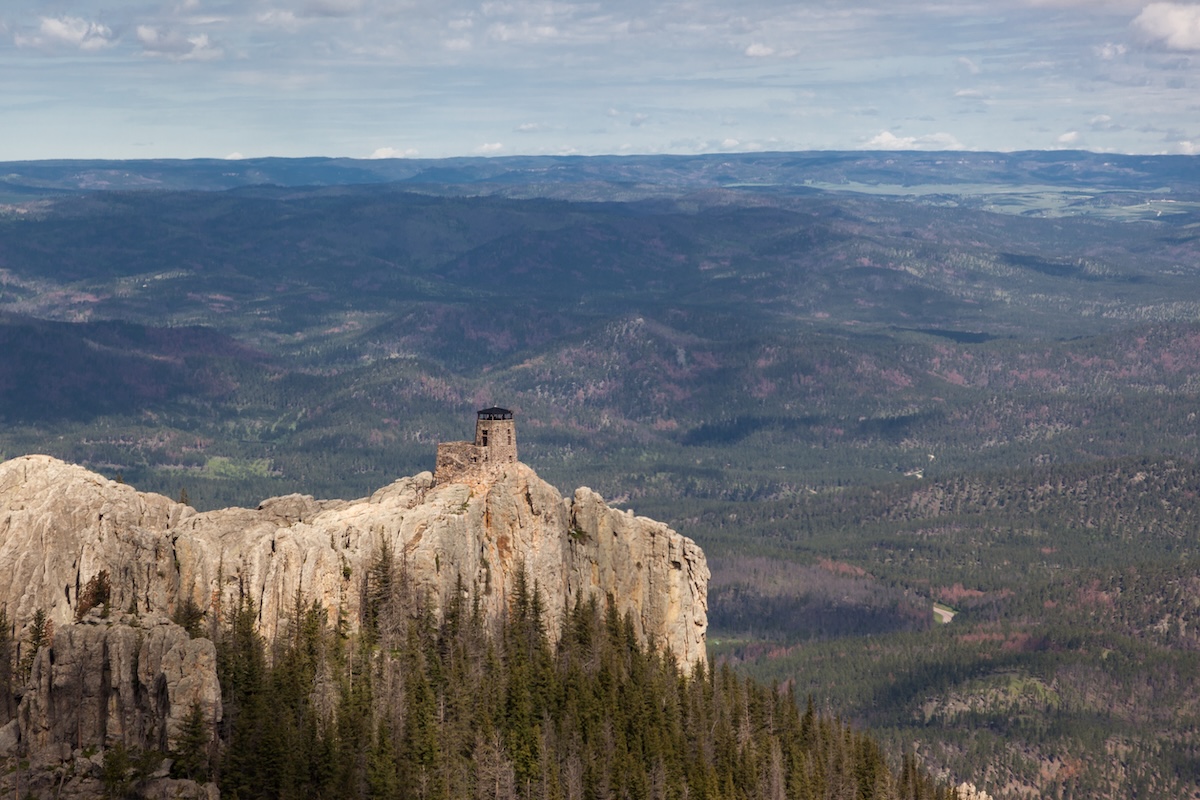
Black Elk Peak, at 7,242 feet, is South Dakota’s highest point, tucked in the Black Hills National Forest near Custer State Park. Until 2016 it was called Harney Peak, but it was renamed to honor Nicholas Black Elk, a respected Lakota leader and spiritual figure. The Black Hills are sacred to the Lakota, and the peak holds special meaning.
Several trails lead to the summit, with the most popular route starting at Sylvan Lake—about 3.5 miles one way. The hike is moderately tough but doable for most active folks. At the top, you’ll find a stone fire lookout tower built in the late 1930s by the Civilian Conservation Corps. On a clear day, the views stretch for miles across granite spires and dense forests.
Tennessee: Clingmans Dome (Kuwohi) (6,643 feet)
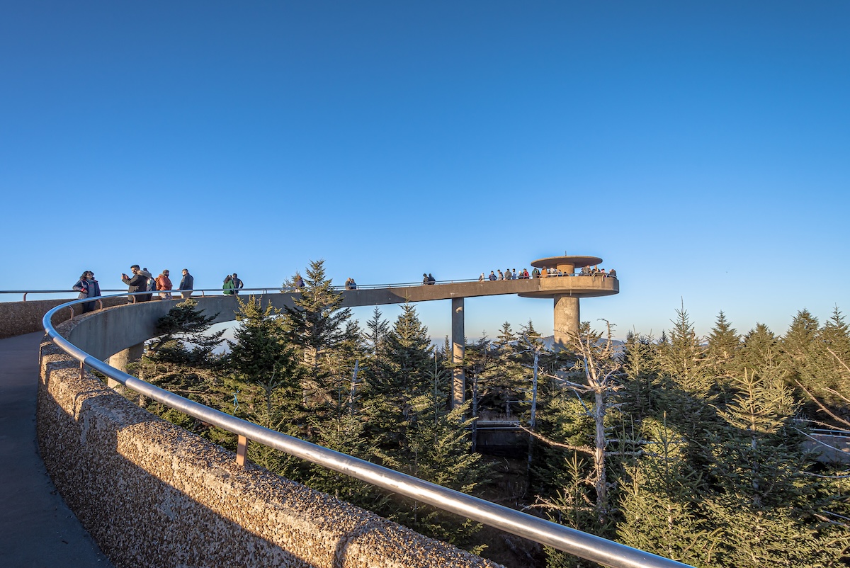
Tennessee’s highest point, Clingmans Dome—now officially Kuwohi—sits on the border with North Carolina in Great Smoky Mountains National Park. At 6,643 feet, it’s the third-highest peak east of the Mississippi. The name Kuwohi, restored in 2024, means “mulberry place” in Cherokee.
To reach the summit, you’ll follow a steep half-mile paved trail from the parking area. Up top, there’s a unique observation tower with a spiral ramp for 360-degree views. On a clear day, you might see as far as 100 miles. The access road usually closes December through March, and summit temps run 10-20 degrees cooler than below. Expect plenty of rain and fog, which keeps the spruce-fir forest lush and green.
Texas: Guadalupe Peak (8,751 feet)
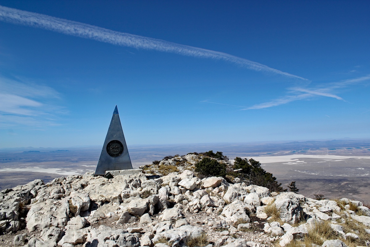
Texas’s highest point, Guadalupe Peak, rises to 8,751 feet in Guadalupe Mountains National Park, about 110 miles east of El Paso. The summit hike is one of the state’s best, covering roughly 8.5 miles round trip and gaining almost 3,000 feet. It’s a tough but doable day hike for most people with decent fitness.
The mountain sits atop an ancient fossil reef from the Permian period, giving the place a rugged, otherworldly look. Most hikers start early to beat the heat and dodge afternoon thunderstorms, especially in summer when temps can spike fast. The summit view stretches across West Texas and into New Mexico—nothing but desert mountains as far as you can see.
Utah: Kings Peak (13,528 feet)
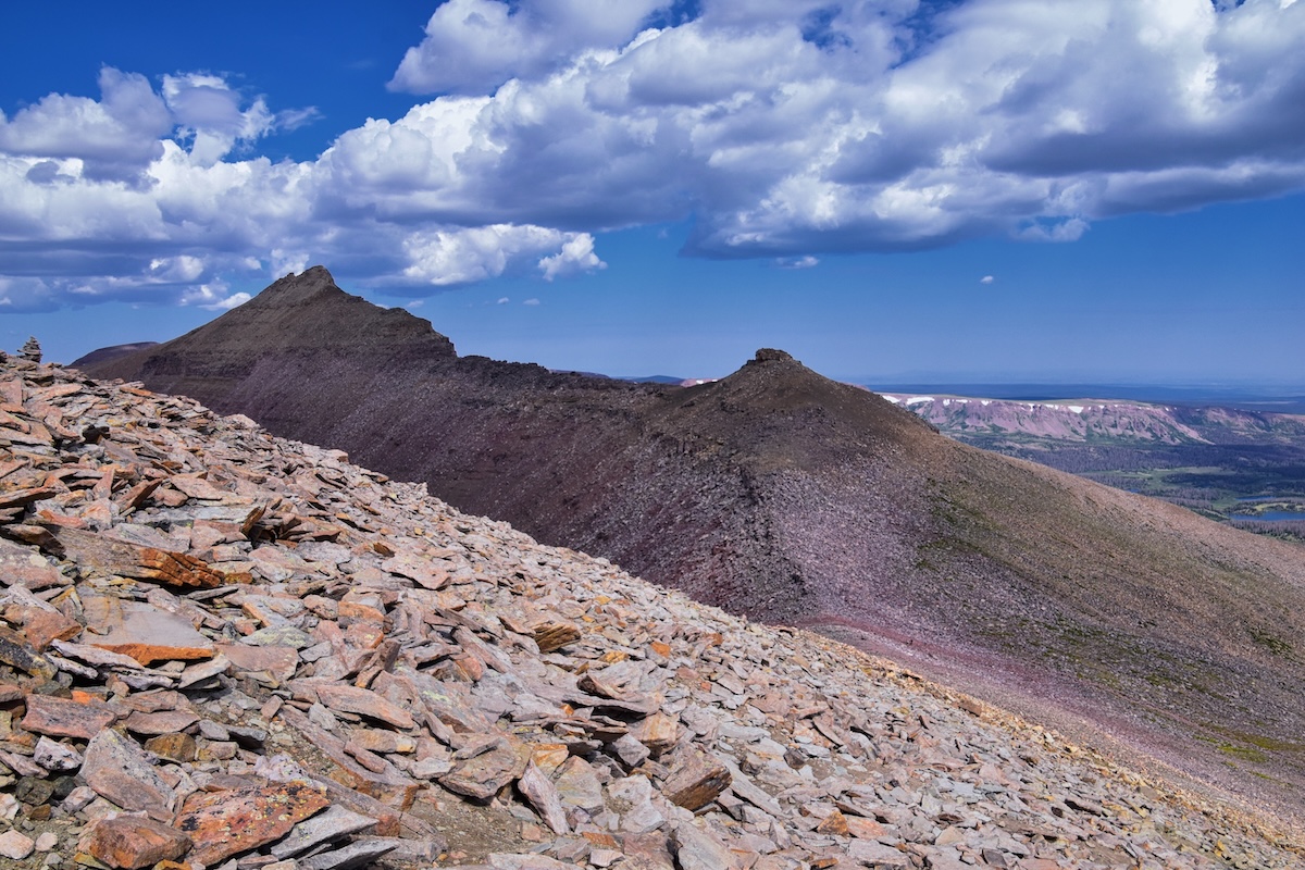
Kings Peak is Utah’s highest summit, rising from the remote Uinta Mountains in the northeast corner of the state. This challenging peak sits deep within the High Uintas Wilderness, so reaching it isn’t exactly a walk in the park. The standard route from Henry’s Fork trailhead is about 30 miles round trip—most folks split it into a multi-day backpacking trip.
The trek to Kings Peak winds through gorgeous alpine terrain: wildflower meadows in summer, clear mountain lakes, and rugged granite ridges. You’ll climb about 4,700 feet from the main trailhead. If you want the best shot at good weather, late July through September is your window—snow blocks the way earlier in the year. The Uinta Mountains run east-west instead of north-south, which is a bit unusual for North America and something you’ll probably notice as you hike.
Vermont: Mount Mansfield (4,393 feet)
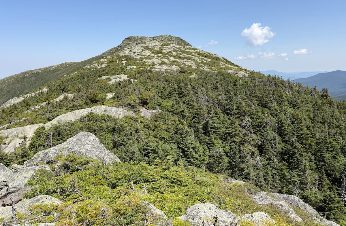
Mount Mansfield is Vermont’s highest peak, topping out at 4,393 feet in the Green Mountains. From the east, the summit looks like a human face—locals call its features the Forehead, Nose, Chin, and Adam’s Apple. It sits within Mount Mansfield State Forest, just outside Stowe, a spot that’s basically a magnet for anyone into the outdoors.
You’ve got a few options to reach the top. The Long Trail is the classic, tougher route, tracing the spine of Vermont. If you want something easier, the Auto Toll Road lets you drive most of the way up in warmer months, then finish with a short hike. Up top, there’s a patch of rare alpine tundra—fragile stuff you won’t find elsewhere in Vermont. On a clear day, the views stretch across multiple states and even into Canada. In winter, backcountry skiers and snowboarders flock here, but the weather can get brutal with high winds and ice.
Virginia: Mount Rogers (5,729 feet)
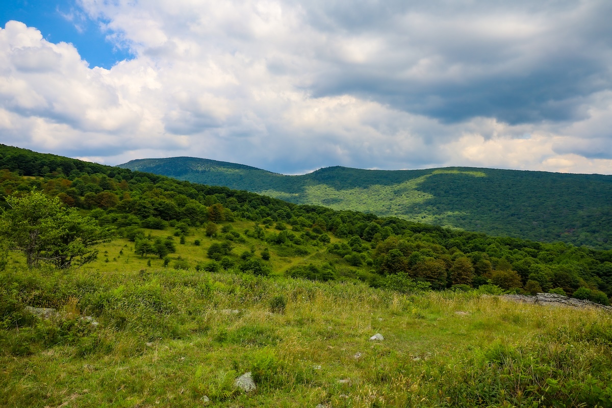
Virginia’s highest point, Mount Rogers, rises to 5,729 feet in the far southwest of the state, tucked into the Jefferson National Forest. The summit sits right on the Appalachian Trail, and you can reach it by several routes, ranging from moderate to a bit of a grind. The top itself is thick with red spruce and Fraser fir, so don’t expect wide-open views—instead, you get a cool, shaded mountaintop that feels more like the Smokies than Virginia.
The most popular hike starts at Massie Gap and runs about 8 miles round trip. Along the way, keep your eyes peeled for the wild ponies that wander the highlands—always a highlight. The area is part of the Mount Rogers National Recreation Area, which has over 200 miles of trails for hiking, backpacking, and horseback riding. Spring and fall are the sweet spots for a visit, with comfortable temps and colorful leaves making the trip extra worthwhile.
Washington: Mount Rainier (14,411 feet)
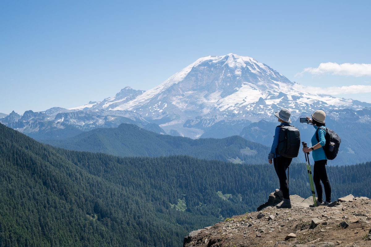
Mount Rainier towers over Washington as its tallest peak and is one of the Pacific Northwest’s icons. Just 60 miles southeast of Seattle, this massive stratovolcano dominates the skyline when the weather cooperates. It’s still considered active, though it’s been over a hundred years since the last big eruption.
If you head to Mount Rainier National Park, you’ll see more than 25 named glaciers draping the peak—it’s the most heavily glaciated mountain in the lower 48. Climbing season runs from May to September, and thousands of mountaineers give it a shot each year. The climb is no joke: serious elevation gain, crevasses, avalanches, and wild weather are all on the table. Most people need two or three days to summit, usually camping overnight at Camp Muir (10,188 feet). If technical climbing isn’t your thing, you can still explore via scenic drives, hiking trails, and meadows that explode with wildflowers in summer.
West Virginia: Spruce Knob (4,863 feet)
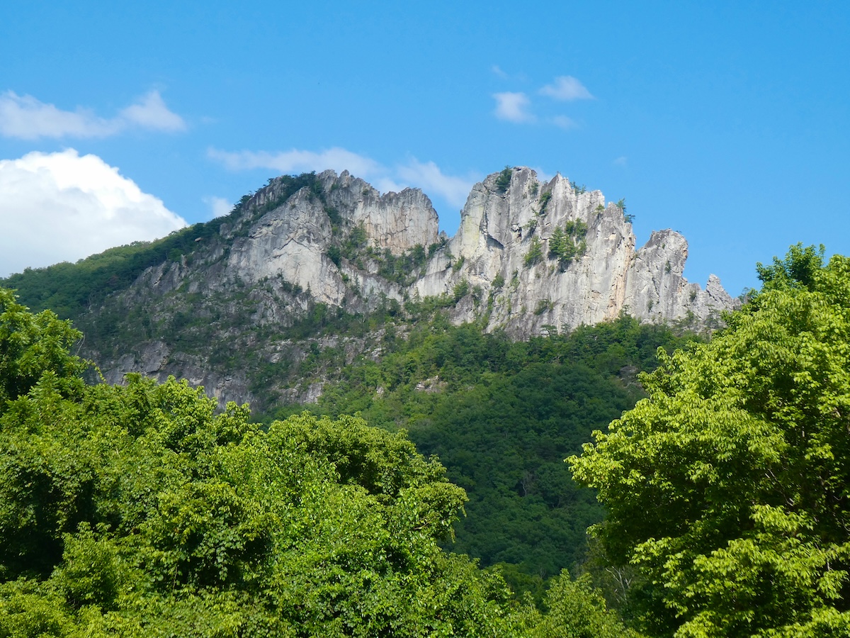
Spruce Knob, at 4,863 feet, is West Virginia’s highest point, perched in the Allegheny Mountains within Monongahela National Forest. The summit sits in Pendleton County, where the cool temps and windswept landscape feel almost subalpine—definitely a change from the rest of the state.
You can drive almost all the way to the top, so it’s one of the most accessible high points in the eastern U.S. There’s a stone observation tower at the summit, offering big views of the ridges and valleys below. If you want to stretch your legs, a handful of trails wind through the unique ecosystem, where red spruce trees grow short and twisted from the harsh weather. The climate up here feels more like Canada than typical West Virginia, with frequent fog and much cooler temps year-round.
Wisconsin: Timms Hill (1,951 feet)
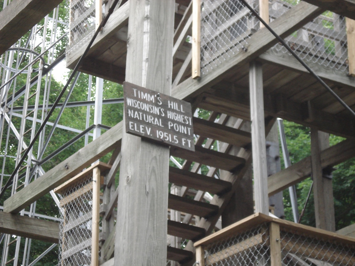
Wisconsin’s highest point, Timms Hill, rises to 1,951 feet in the north-central part of the state. It’s tucked away in Price County near Ogema, inside Timms Hill County Park, and is one of the easiest highpoints to reach anywhere. The hill got its name from a local timber cruiser back in the logging days.
At the summit, you can climb an observation tower for sweeping views above the forests. The park is quiet and laid-back, with picnic spots and trails—no special gear or mountaineering needed. A paved path leads right from the parking lot to the top, so it’s a breeze for families and casual hikers. The surrounding Northwoods region is classic Wisconsin: lakes, woods, and small towns that are worth poking around while you’re in the area.
Wyoming: Gannett Peak (13,810 feet)
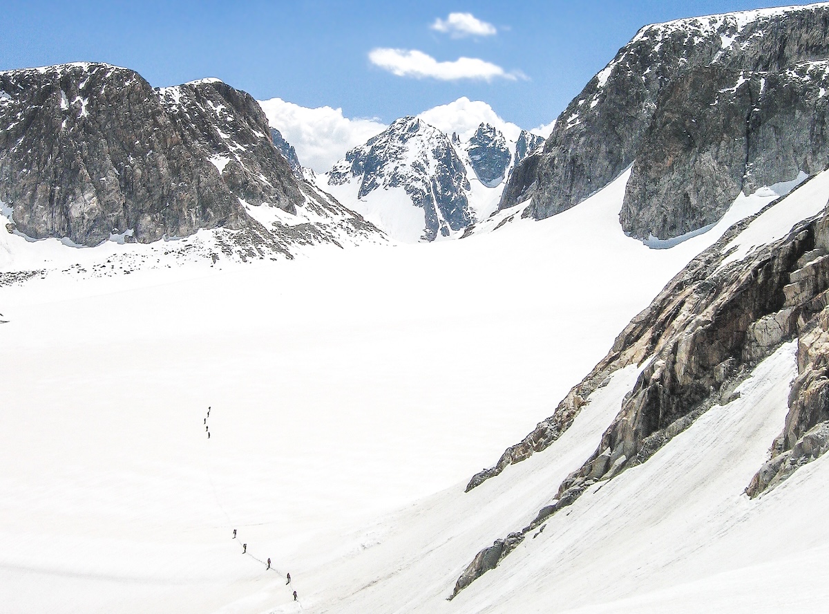
Wyoming’s highest point hides deep in the Wind River Range, where Gannett Peak reaches 13,810 feet. You can’t just drive to the top or squeeze this one into a casual afternoon—it’s a serious undertaking. Most folks spend three to five days making the round trip.
Getting there means crossing glaciers like the Gooseneck, which can get technical fast. You really need mountaineering skills, solid gear, and probably a guide if you haven’t tackled glacier travel before. The peak sits inside the Bridger Wilderness, surrounded by rugged alpine scenery—honestly, it’s some of the wildest country Wyoming has to offer. Weather up there? It can turn on a dime, so most people aim for summer when things are a little less unpredictable.