
America has no shortage of trails that will humble you. Most are perfectly safe with adequate preparation, but this is advice that is routinely ignored, so search and rescue teams are just permanently on high-alert mode.
Each one of these hikes has its own threat level. You could be dangling from the edge of a cliff or be slithering through cracks that risk you becoming the next source material for 127 Hours. What they all share is a margin for error and the ability to breed terror. That, and a body count that should already scare you off. But as is the nature of the adventurous traveler, that doesn’t happen easily.
12. Presidential Traverse, White Mountains, New Hampshire
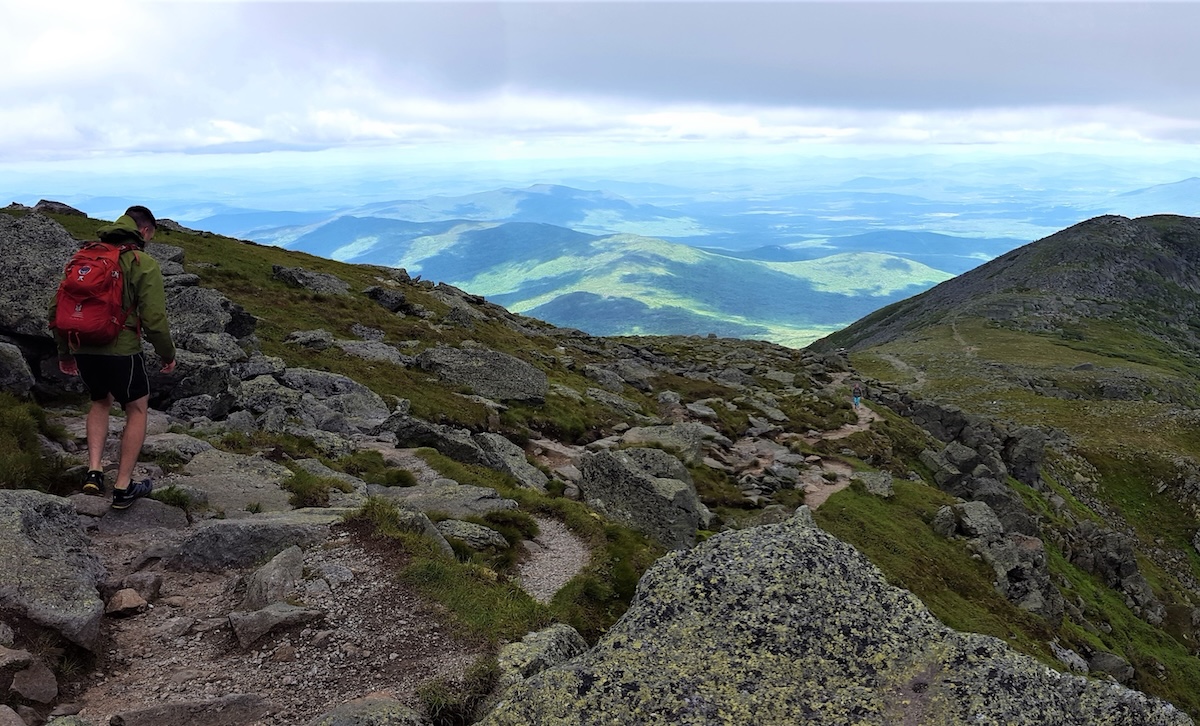
The White Mountains of New Hampshire are not large by western standards, but Mount Washington and its neighboring Presidential peaks have killed more people than many mountains twice their elevation. The traverse links eight summits along an exposed ridge, finishing at Mount Washington’s summit at 6,288 feet, where weather systems arrive fast and furious.
The trail itself is not technically demanding, but the exposure is near-total, and conditions shift without warning. In 1934, the summit recorded a wind speed of 231 miles per hour, a record that stood for over six decades. Most experienced hikers treat this as a two-day traverse built around the forecast, and even then, the mountain has the final say.
11. Devil’s Path, Catskill Park, New York
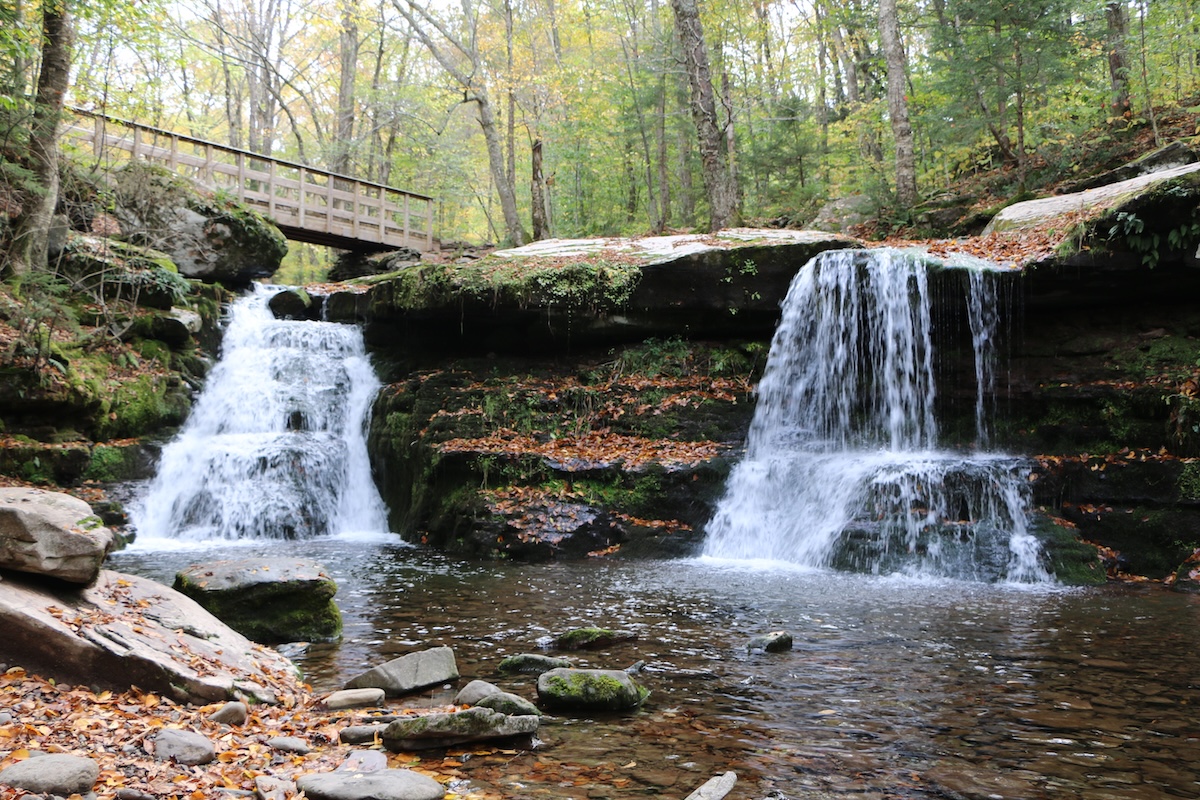
Named with appropriate honesty, Devil’s Path runs through the heart of the Catskills and links seven steep peaks in a traverse that the American Hiking Society has listed among the most strenuous hikes in the Northeast. The elevation changes are punishing for a range this modest in height, with descents and re-ascents that accumulate over the course of the day and your knees will remind you of it long after returning home.
The Catskills sit close enough to New York City that this trail regularly draws hikers who underestimate it based on the drive up. Devil’s Path quickly corrects that assumption without mercy.
10. Knife Edge Trail, Mount Katahdin, Maine
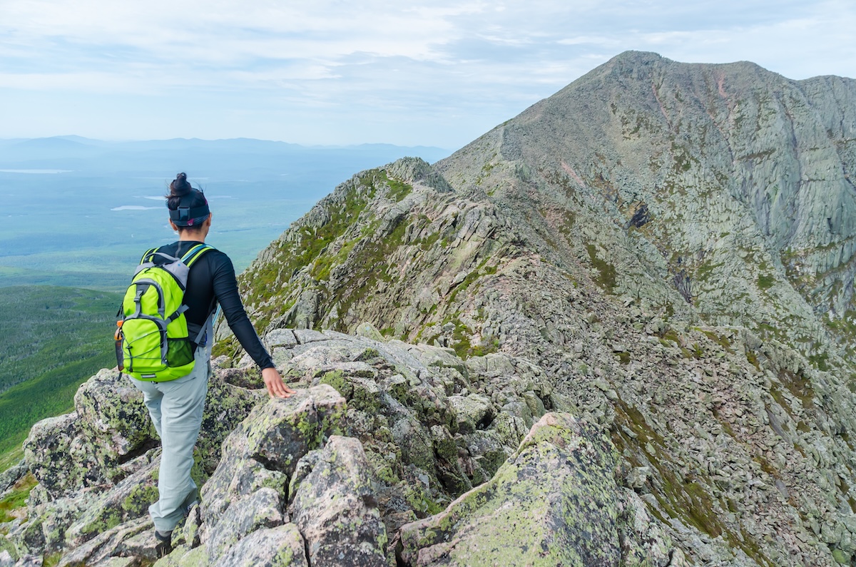
Few trails in America make the stakes as literal as Knife Edge on Mount Katahdin. The ridge runs for roughly a mile at elevations above 4,000 feet, narrowing in places to less than three feet wide, with sheer drops on both sides into nothing.
You will need permits to visit Maine’s highest peak, and you will need to reassess your vertigo honestly before attempting Knife Edge. People turn back every season and are making the right call more often than they realize. Don’t be a hero! Know your limits!
9. Lost Coast Trail, California
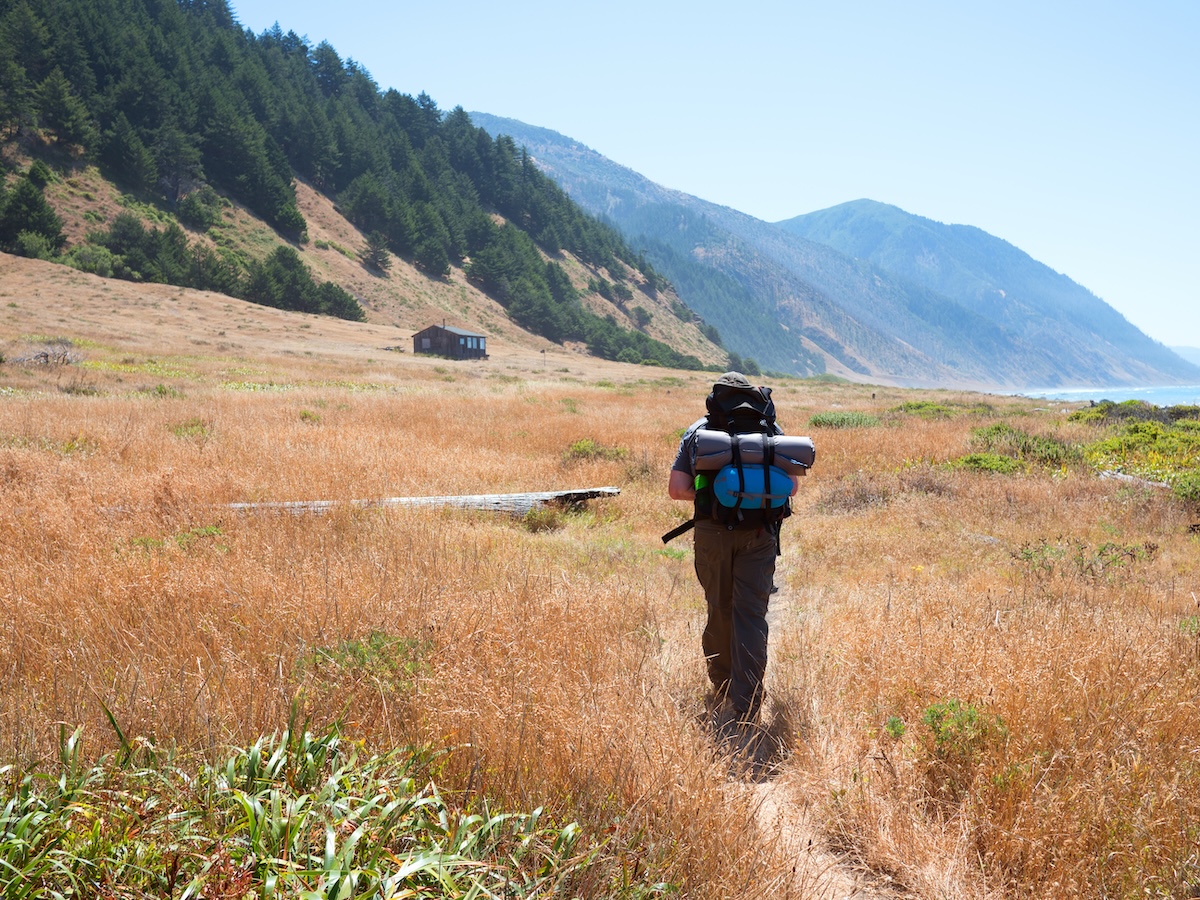
California’s Lost Coast earned its name because even Highway 1 couldn’t be routed through here. All because the King Range drops too steeply into the Pacific. The trail runs along a remote stretch of Humboldt County coastline where sections are only passable at low tide, and getting the timing wrong means the ocean ends your hike without asking for permission.
The terrain is unrelenting: soft sand and loose rock under a coastal climate that does whatever it wants. If you are well-prepared, you will adore the near-total solitude on one of California’s most dramatic stretches of coastline.
8. Barr Trail, Pikes Peak, Colorado
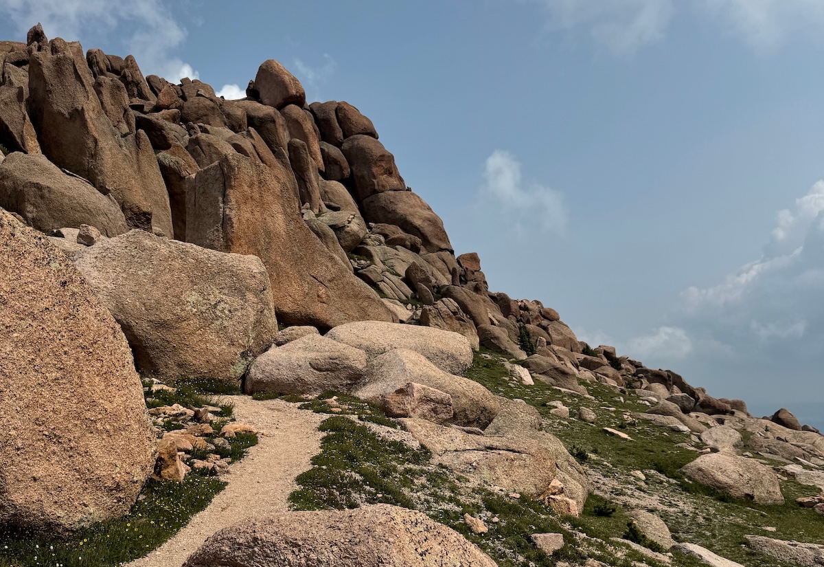
Pikes Peak sits at 14,115 feet, and Barr Trail covers thirteen miles each way from Manitou Springs at the base. The elevation accumulates slowly over hours of hiking, and altitude sickness does not care how fit you are or how many peaks you have summited before this one.
Afternoon thunderstorms move in above the tree line with little warning, making the pre-dawn start mandatory if you are a serious hiker. Completing the summit also means arriving back exhausted to a visitor center full of tourists who drove up the road. A little deflating to say the least.
7. Kalalau Trail, Hawaii
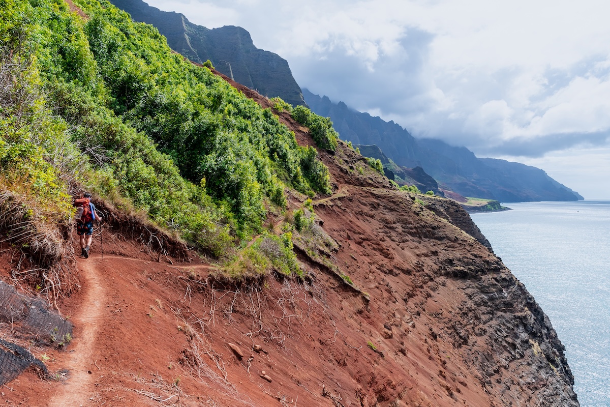
Hawaii sounds easy until you look at the Napali Coast. Kalalau Trail runs eleven miles along sheer sea cliffs on Kauai’s north shore, crossing five valleys over exposed ledges and river crossings sees flash-flood without warning during the rainy season. This is your warning…
The state limits access with permits, partly for conservation and partly because the trail has swept hikers off cliffs and swallowed others in river crossings. It is one of the most beautiful places in the United States, and the landscape takes no interest in keeping you safe.
6. South Kaibab Trail, Grand Canyon, Arizona
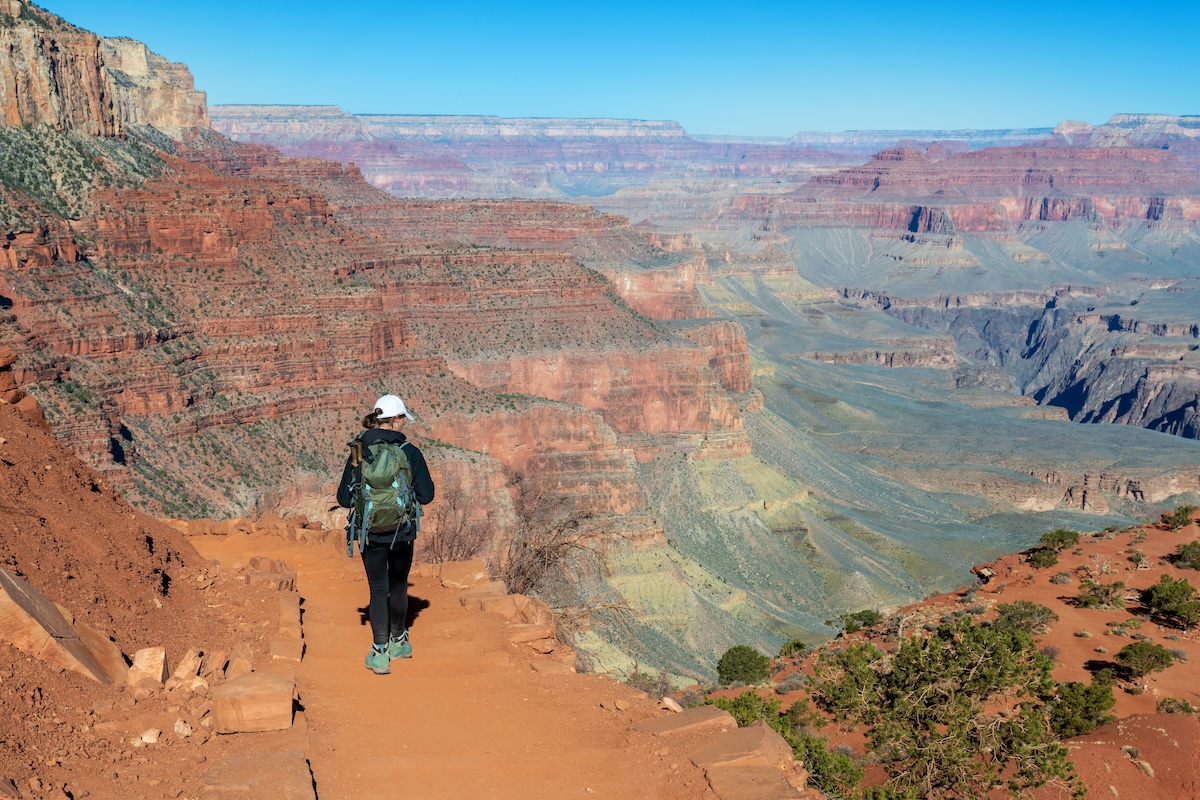
South Kaibab is one of the most exposed routes in the Grand Canyon and drops nearly 4,800 feet over seven miles to the Colorado River. There is no water on the trail and very little shade, and the return trip uphill in full canyon heat is where most rescues happen.
The National Park Service advises against hiking to the river and back in a single day. But of course, visitors disregard that, which keeps the rescue helicopter on a reliable schedule. The views are exceptional, and the canyon heat will turn every optimistic calculation about your water supply into a problem.
5. Longs Peak Keyhole Route, Colorado
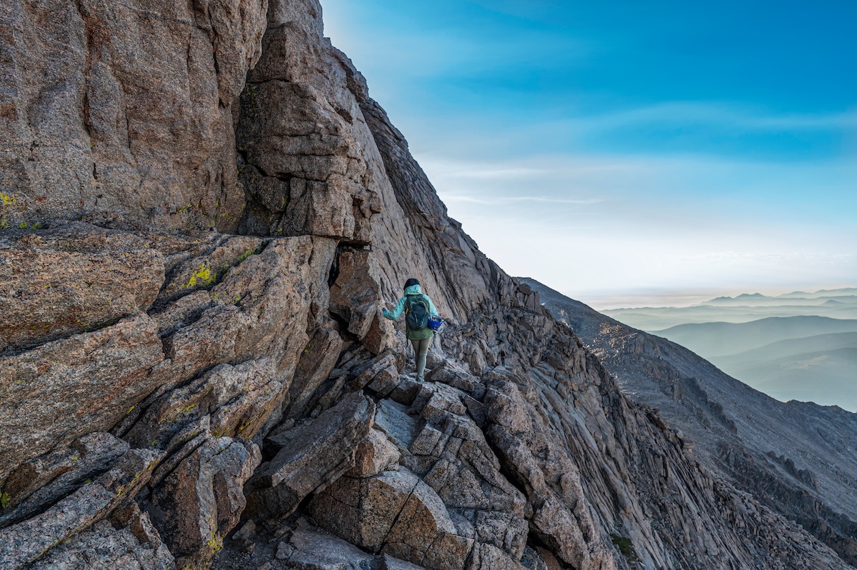
Colorado’s northernmost fourteener sits at 14,259 feet, and the Keyhole Route covers fifteen miles round trip with 5,100 feet of elevation gain. Above the Keyhole, the trail disappears entirely, and the route requires scrambling across exposed ledges with a long way down in most directions.
Lightning is the biggest threat once you move past the treeline, and most climbers start before 3 a.m. to be off the exposed terrain before afternoon storms arrive. Longs Peak claims multiple lives most years, and they are not all inexperienced hikers either.
4. Angels Landing Trail, Utah
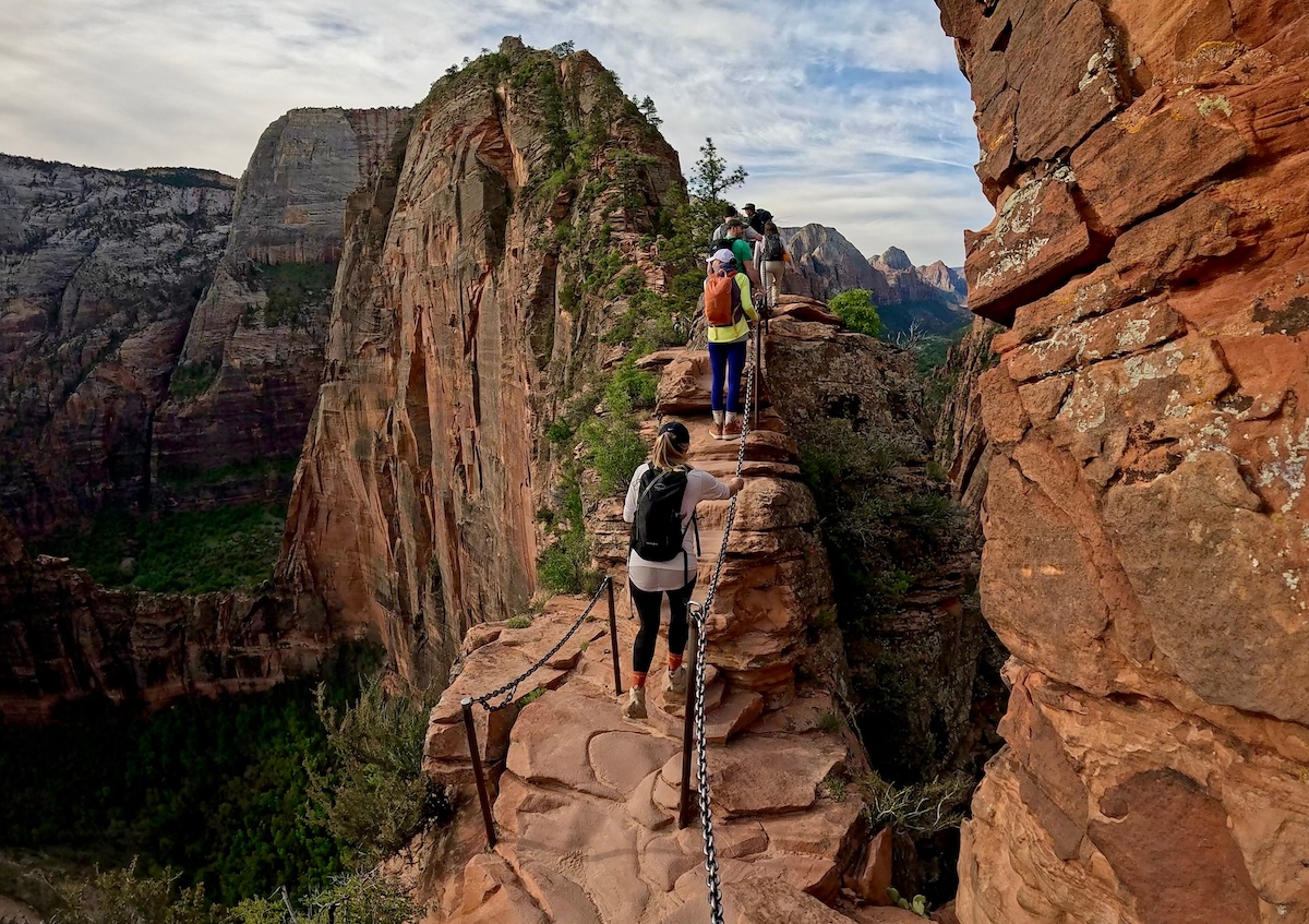
Zion National Park introduced a permit lottery for Angels Landing after fatalities made the trail’s popularity a problem. And signage alone wasn’t going to manage. The final half-mile climbs a narrow sandstone spine using chains bolted into the rock, with drops of up to 1,500 feet on both sides.
The permit system has thinned the crowds that once turned the chains into a bottleneck of overlapping bad decisions. The views from the top are extraordinary, and the half-mile of chains that leads you there is one of the more clarifying experiences in the American Southwest.
3. Half Dome Trail, California
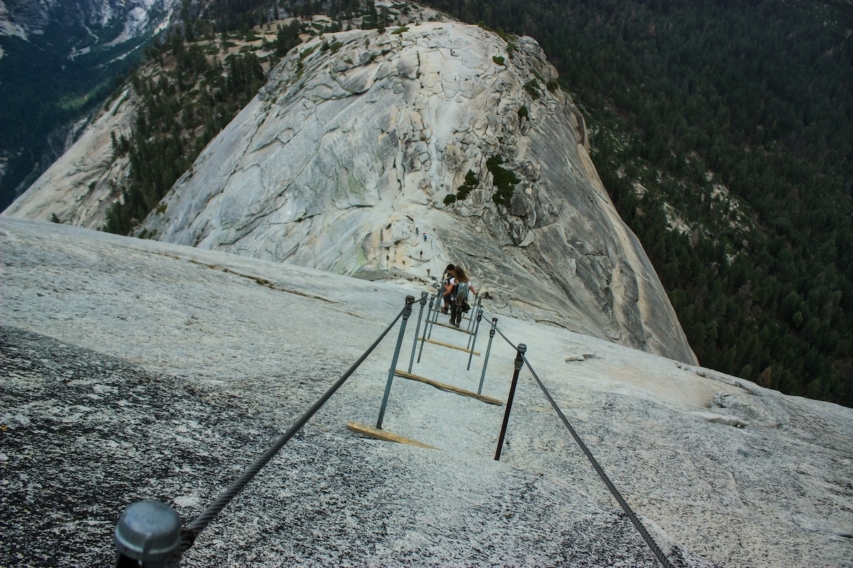
Yosemite’s Half Dome is another permit-only climb if you want to attempt the cable section. The cables are installed each spring after the snow clears, so this isn’t a year-round thing either. The final 400 feet up the dome’s sheer granite face uses steel cables and wooden crossbars as a fixed ladder, and wet conditions make the accident rate climb sharply.
The round trip covers about sixteen miles with 4,800 feet of elevation gain before the cables even begin. The dome has claimed lives in clear conditions, and when the weather turns, the park recommends immediate descent. This is backed by the double digits on the death-toll counter.
2. The Maze, Canyonlands National Park, Utah
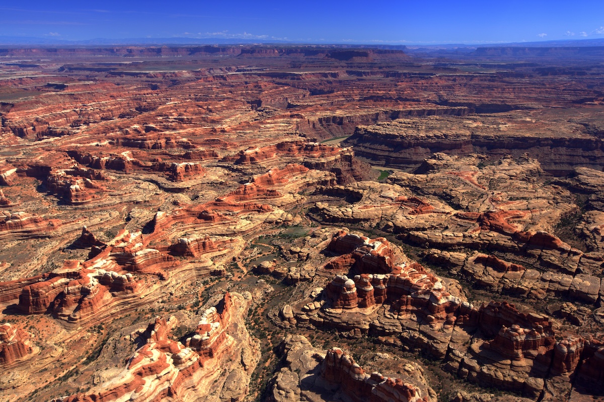
The first obstacle to getting to The Maze is that you need a high-clearance four-wheel-drive vehicle. You will be covering roads that don’t technically count as roads, and infrastructure is a term that hasn’t reached these parts yet. The hike itself enters a sandstone labyrinth named for self-evident reasons, where navigation is entirely on the hiker, and a wrong turn can mean days of additional effort.
Rangers recommend a minimum three-day water supply and a topographic map you can actually read. The Maze sees almost no foot traffic, and when something goes wrong here, help takes longer than anyone finds comfortable.
1. Huntington Ravine Trail, Mount Washington, New Hampshire
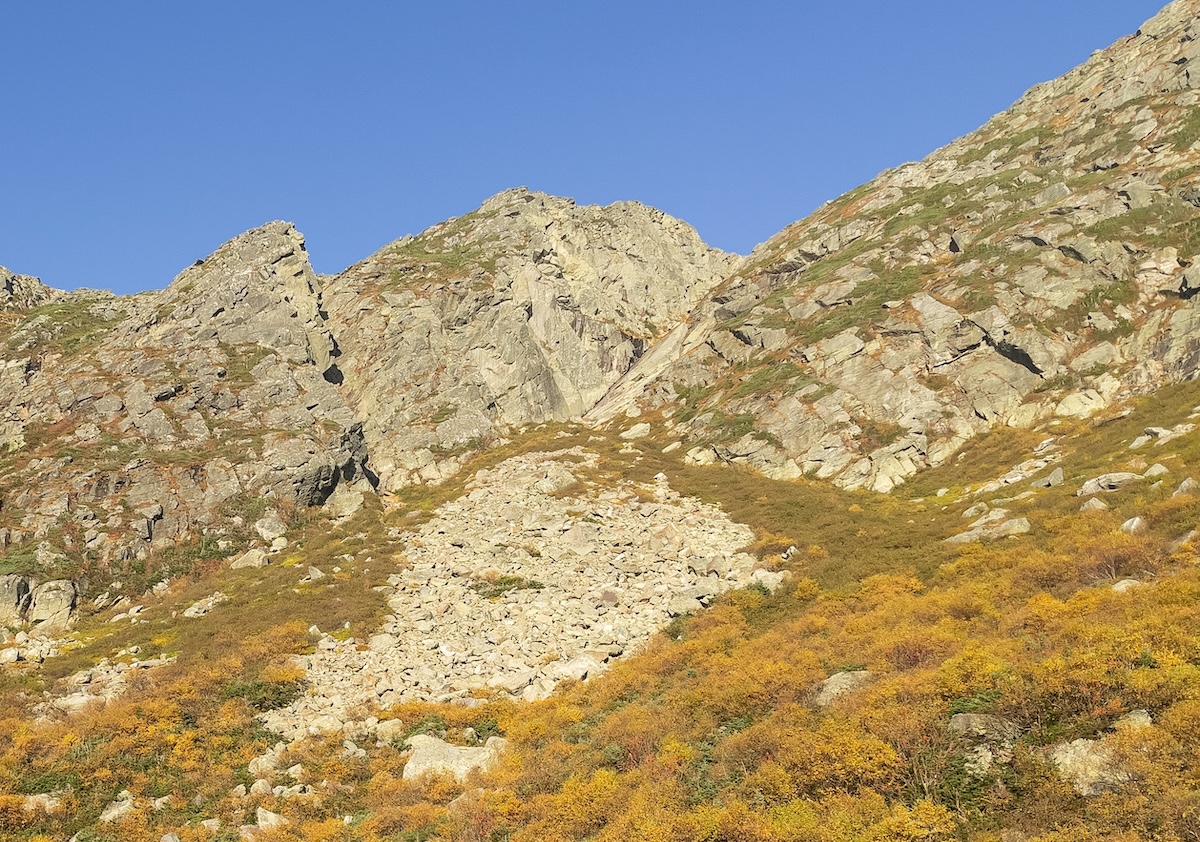
Mount Washington appears twice on this list, which tells you something about what New Hampshire thinks about safety. Huntington Ravine Trail is the steepest maintained hiking trail in the Northeast, climbing ice-carved gullies on the mountain’s eastern face with sections that require hands and feet simultaneously.
The summit generates its own weather systems and holds the world record for measured surface wind speed. Over 160 people have died on this mountain, with Huntington Ravine accounting for a disproportionate share, and the trail has claimed lives even in July, because Mount Washington does not moderate its behavior for the season.